Photos of Li Chen
in 2021
in 2021
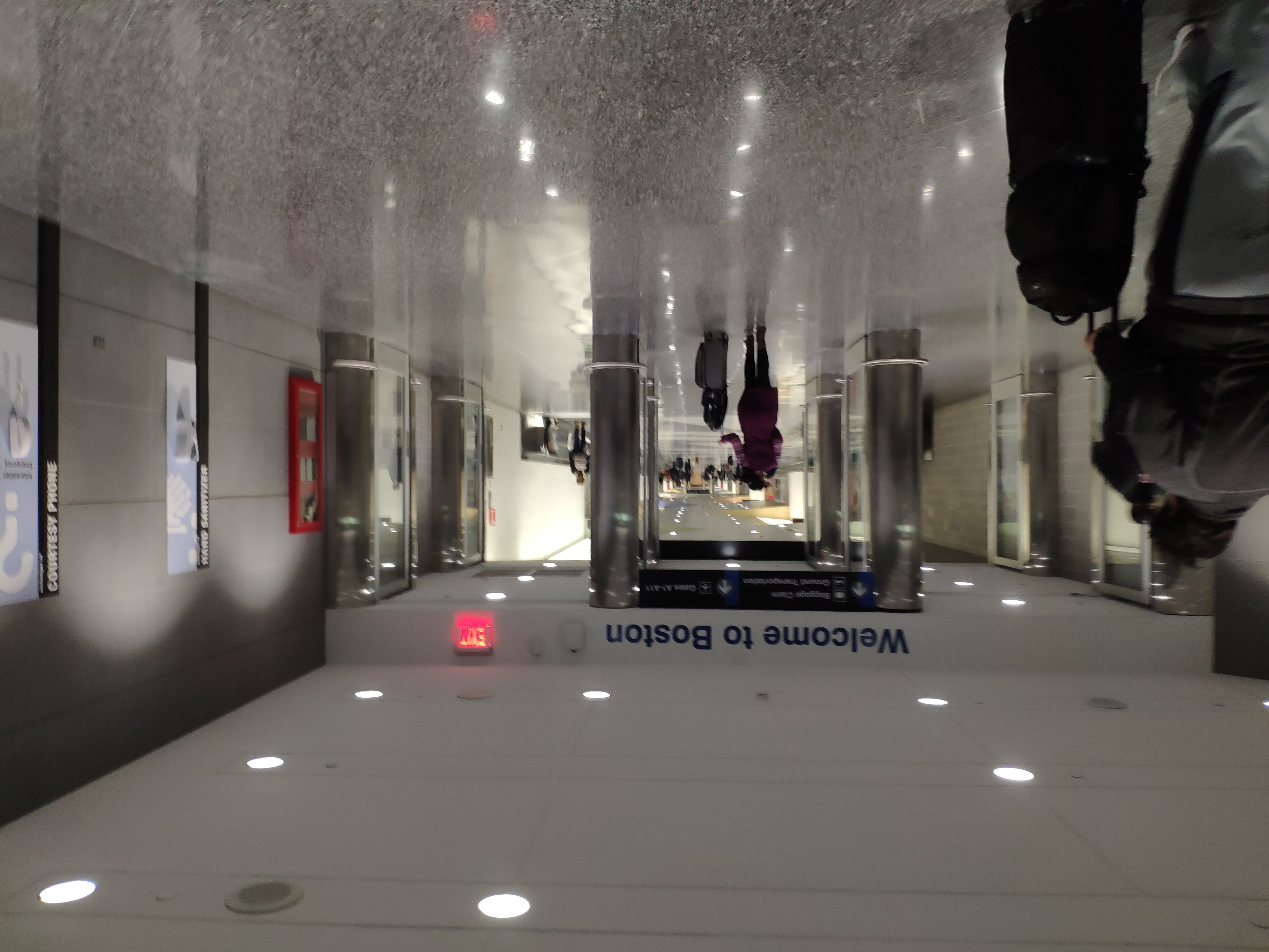
Captured on: 2021-12-17 06:02:51
GPS location: 42.364105, -71.022104
Camera: Xiaomi Mi MIX 2S Focal:4.22 ISO:506 Shutter:5.06
Description: New life in Boston.

Captured on: 2021-11-20 19:45:14
Camera: Xiaomi Mi MIX 2S Focal:4.22 ISO:682 Shutter:5.06
Description: OK, you can call me Dr. Chen now.

Captured on: 2021-10-06 14:42:38
Camera: Xiaomi Mi MIX 2S Focal:4.22 ISO:497 Shutter:5.64
Description: Finally, five years' research in this dissertation.

Captured on: 2021-09-25 12:00:00
GPS location: 47.498167, -120.83322 Altitude: 1,696m
Camera:
Description: Finally went to the famous enchantment trail. Photo credit: Kenny
Captured on: 2021-09-06 11:00:00
GPS location: 18.274370, -65.731476
Camera:
Description: Never though a hiking can be so exciting
Captured on: 2021-07-04 14:47:10
GPS location: 63.565621, -149.642161 Altitude: 1,091m
Camera: Arashi Vision Insta360 ONE X2
Description: Longest mountain biking trip. The most flexible and healthy way to enjoy the picturous view in Denali. Early July is defintely the best time to go, as you would never worry about the return before dark. Photo credit: Mingwei

Captured on: 2021-06-22 00:00:00
Camera:
Description: An exciting moment after months of job hunting.
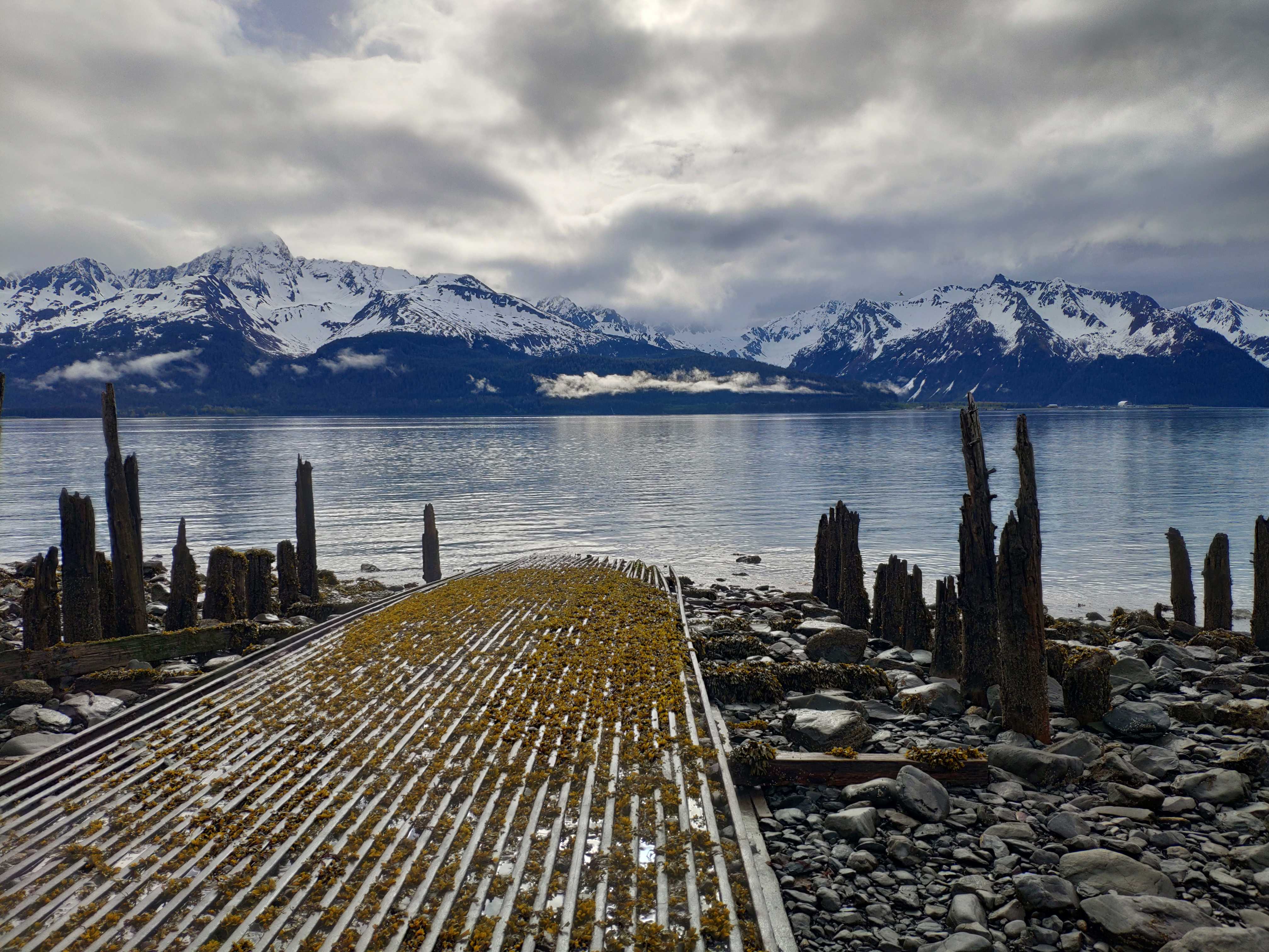
Captured on: 2021-05-30 08:43:07
GPS location: 60.104760, -149.433136
Camera: Xiaomi MIX 2S Focal:4.22 ISO:100 Shutter:10.89
Description: Wander in the waterfront park before the Kenai Fjords Tours. Everything was so peaceful in this Alaska seashore town. Seaweed on rails, a humpback whale in the sea and snow mountains.
Captured on: 2021-05-16 12:06:49
GPS location: 48.514336, -120.661765
Camera: Apple iPhone XR Focal:4.25 ISO:25 Shutter:13.22
Description: A popular back country tour for beginners to enjoy birthdays. A nice day with great view. Photo credit: Shabby
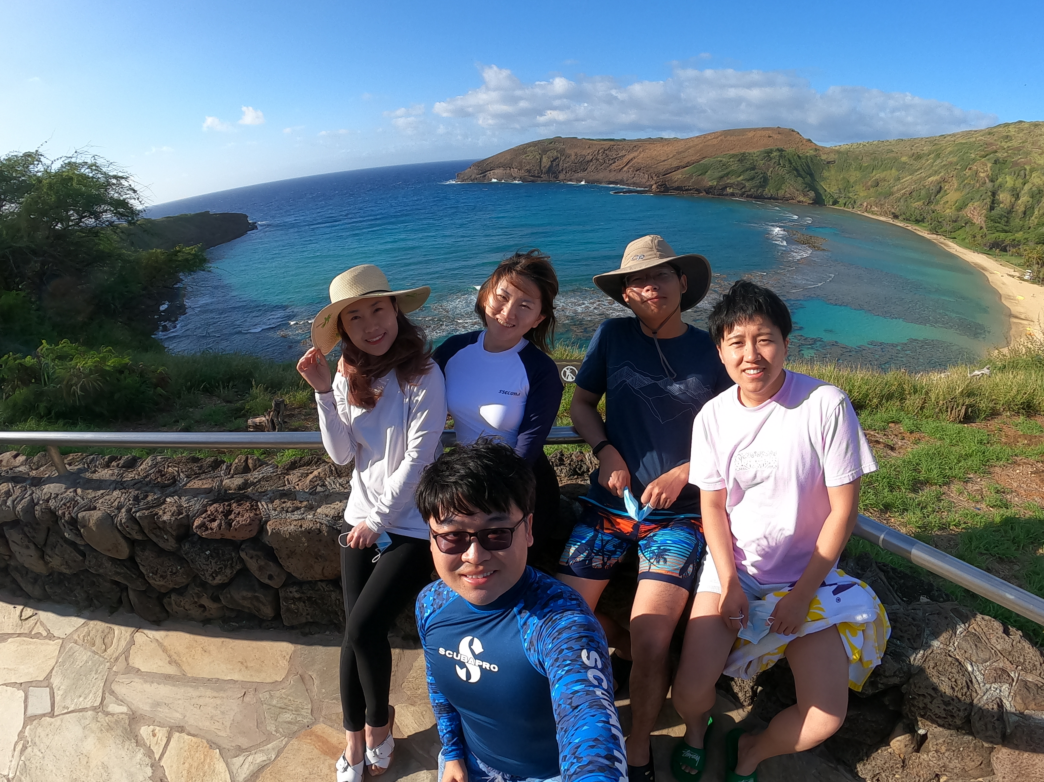
Captured on: 2021-05-08 07:45:00
GPS location: 21.273268, -157.694828 Altitude: 57m
Camera: GoPro HERO9 Black Focal:3.00 ISO:109 Shutter:10.00
Description: Hard to get a reservation. Good to see coral reefs are growing back after a year of lockdown during COVID. Photo credit: Mingwei
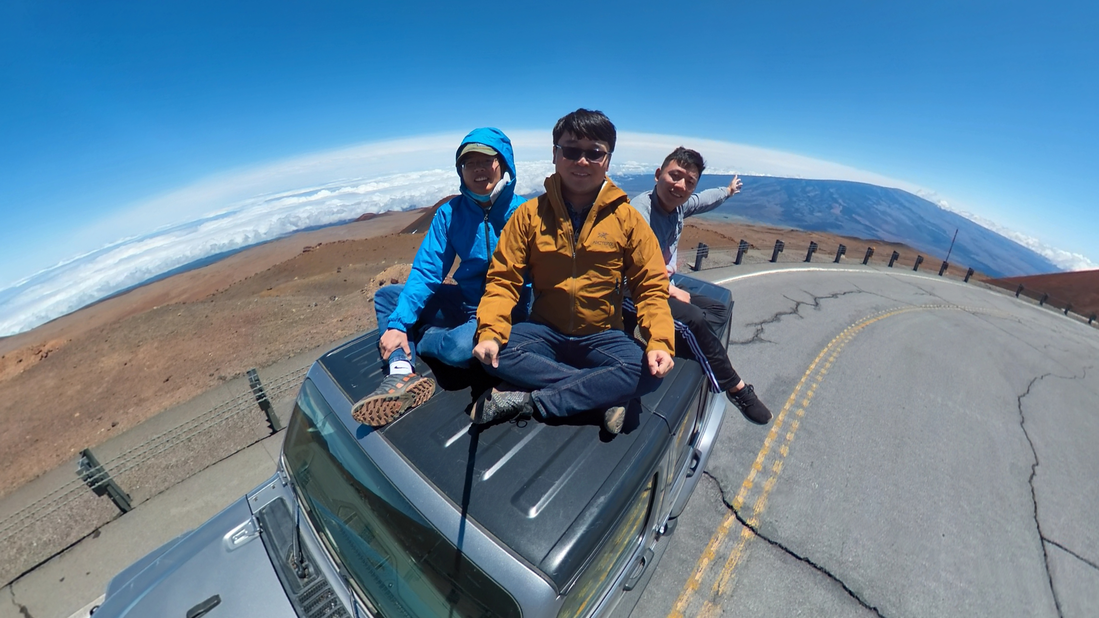
Captured on: 2021-04-25 13:17:15
GPS location: 19.816564, -155.467506 Altitude: 4,090m
Camera: Arashi Vision Insta360 ONE X2
Description: Road to Mauna Kea is so rough that only a rough all weel drive like Jeep Wrangler can handle. With a short ride, we are above the cloud.
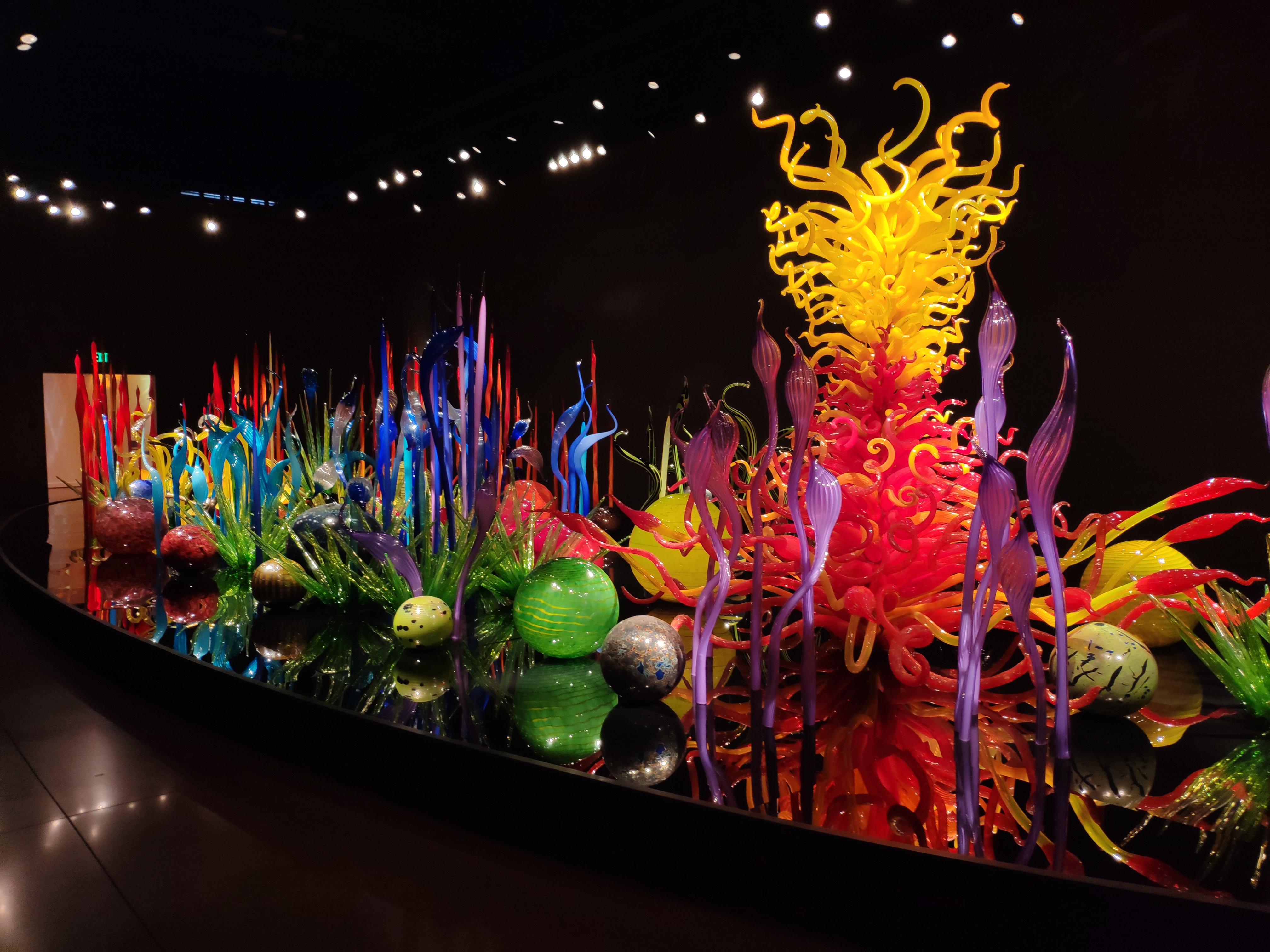
Captured on: 2021-02-07 15:28:37
GPS location: 47.620568, -122.350319
Camera: Xiaomi MIX 2S Focal:4.22 ISO:220 Shutter:4.64
Description: Arts with impressive color and texture of glass. They are even better looking in photos than through eyes.

Captured on: 2021-12-11 19:42:01
GPS location: 47.719836, -122.295119 Altitude: 61m
Camera: Apple iPhone 13 Pro Focal:1.57 ISO:1,000 Shutter:5.38
Description: See you my old and new friends in Seattle. Photo credit: Mingwei
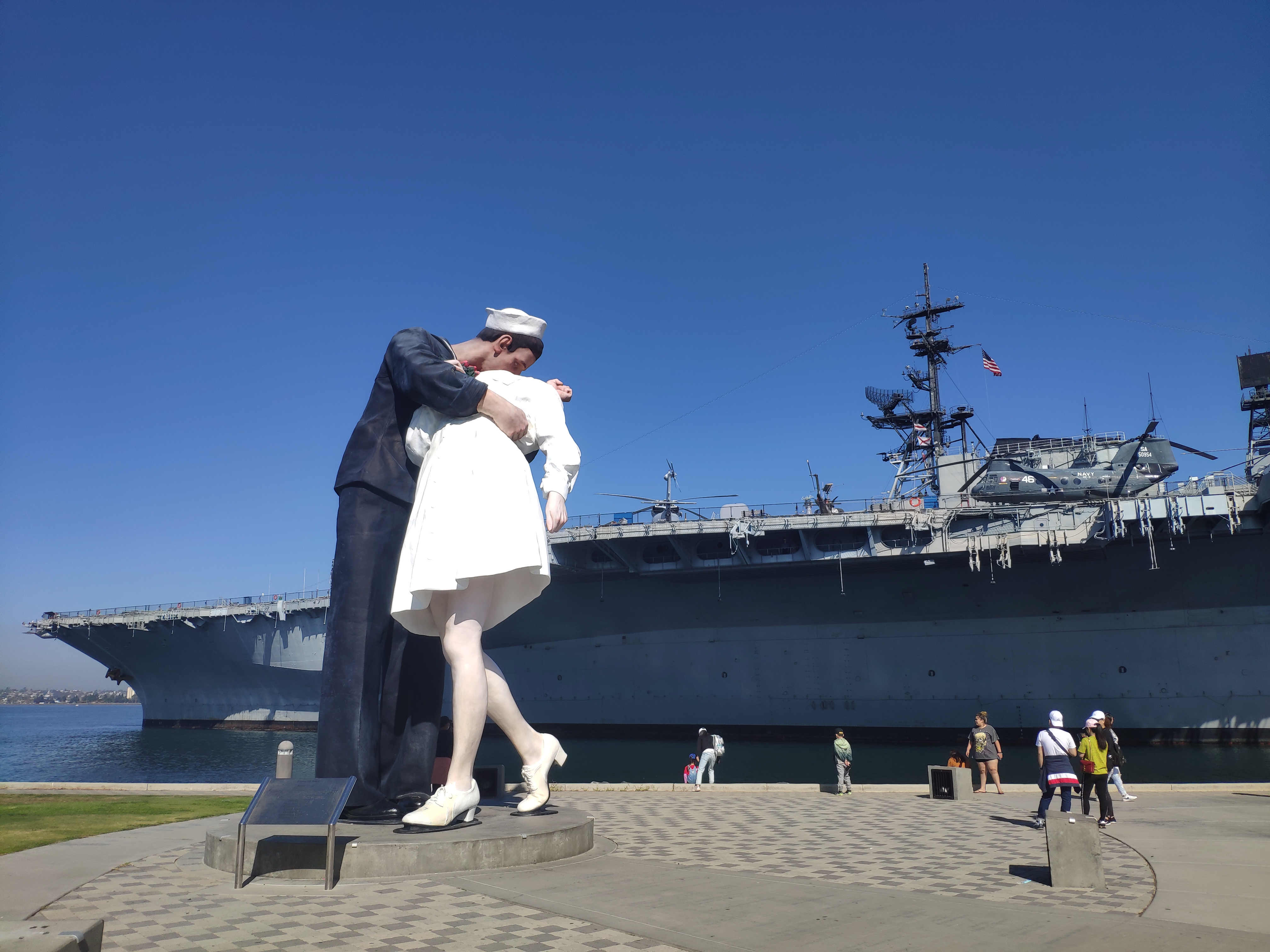
Captured on: 2021-10-17 10:40:09
GPS location: 32.712810, -117.175185
Camera: Xiaomi Mi MIX 2S Focal:4.22 ISO:100 Shutter:11.57
Description: Really enjoyed every detail of the USS Midway. A rare experience to navy's life on a real retired ship.
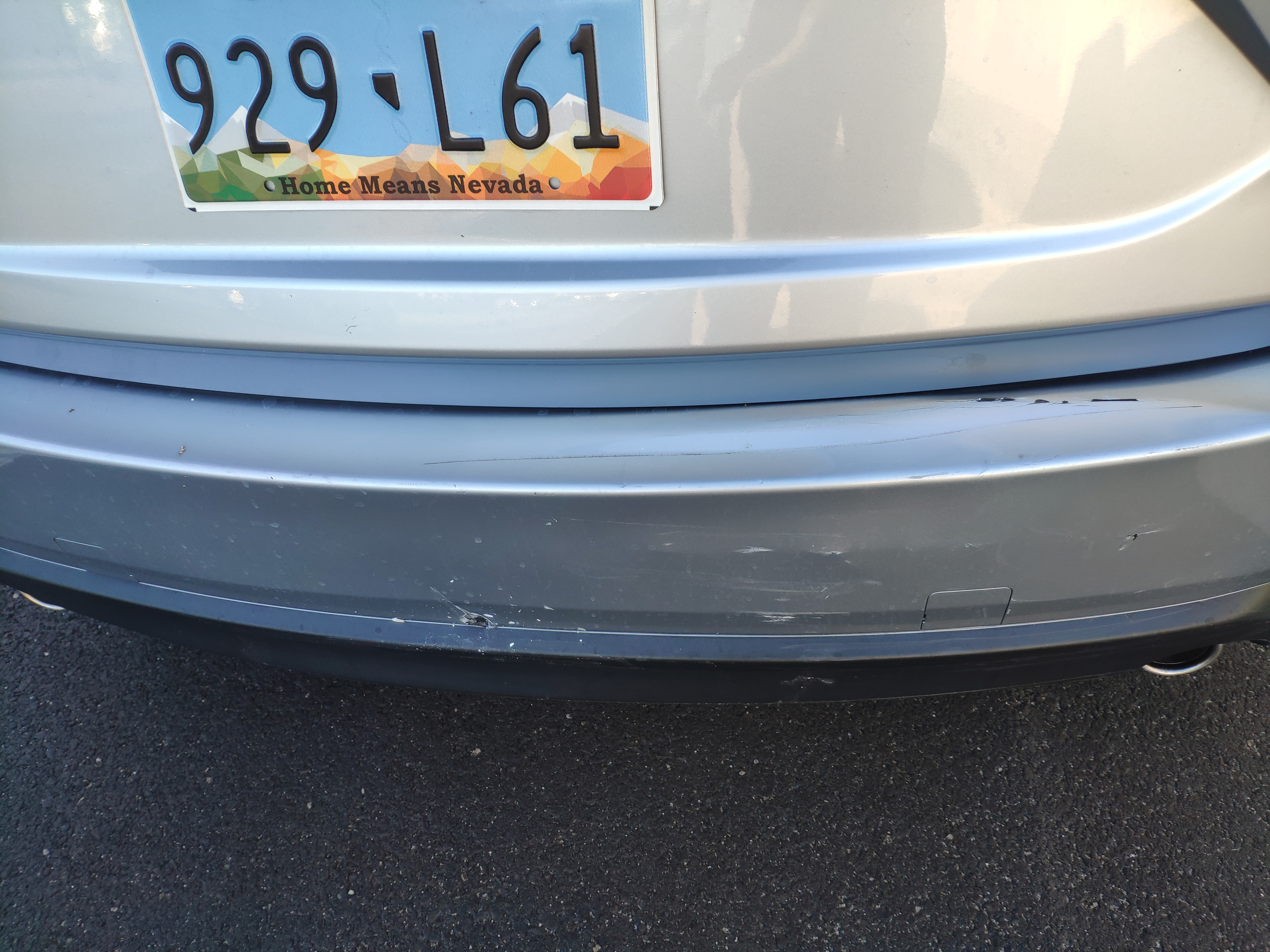
Captured on: 2021-10-16 17:18:31
GPS location: 33.813932, -118.168364
Camera: Xiaomi Mi MIX 2S Focal:4.22 ISO:100 Shutter:7.35
Description: Involved in my first car accident/first time call 911. Bad traffic (fast and slow) + LA people's aggresive driving habit = rear-end collision on my rental car.
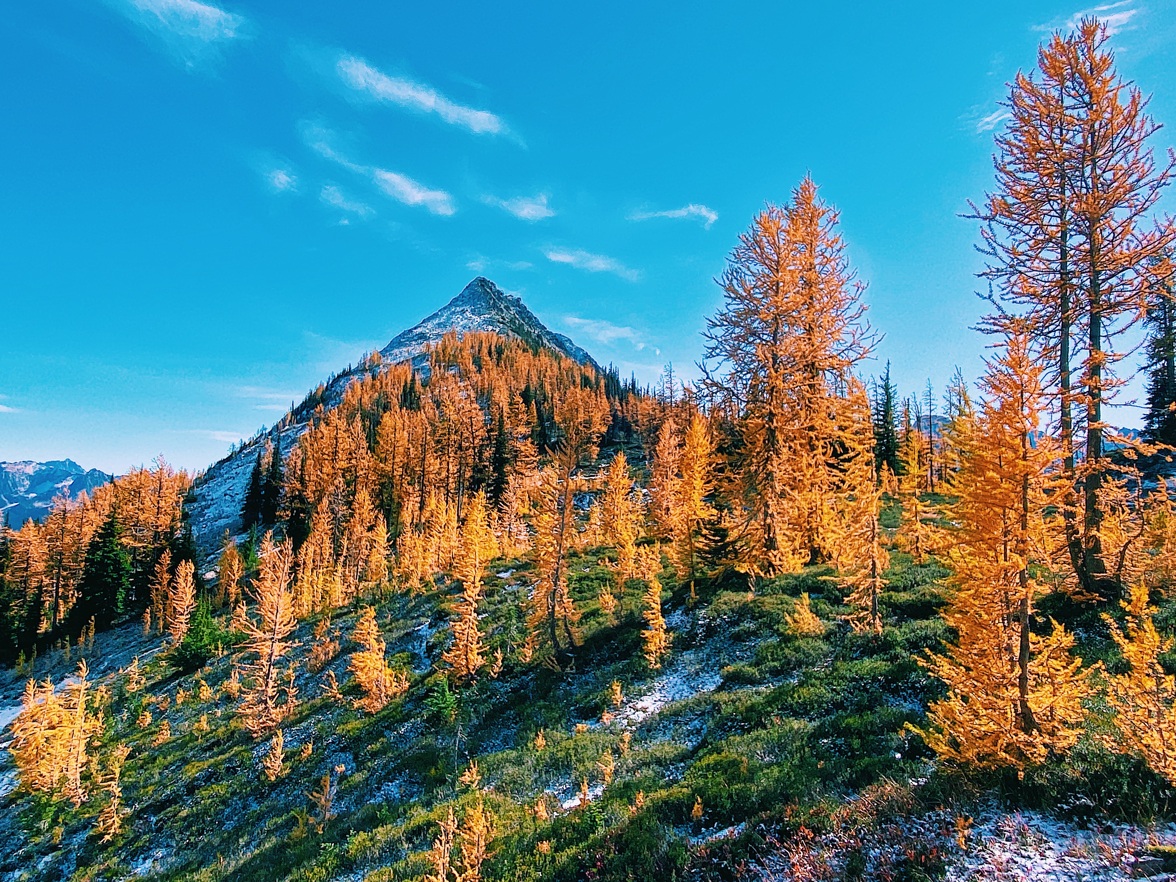
Captured on: 2021-10-08 13:04:46
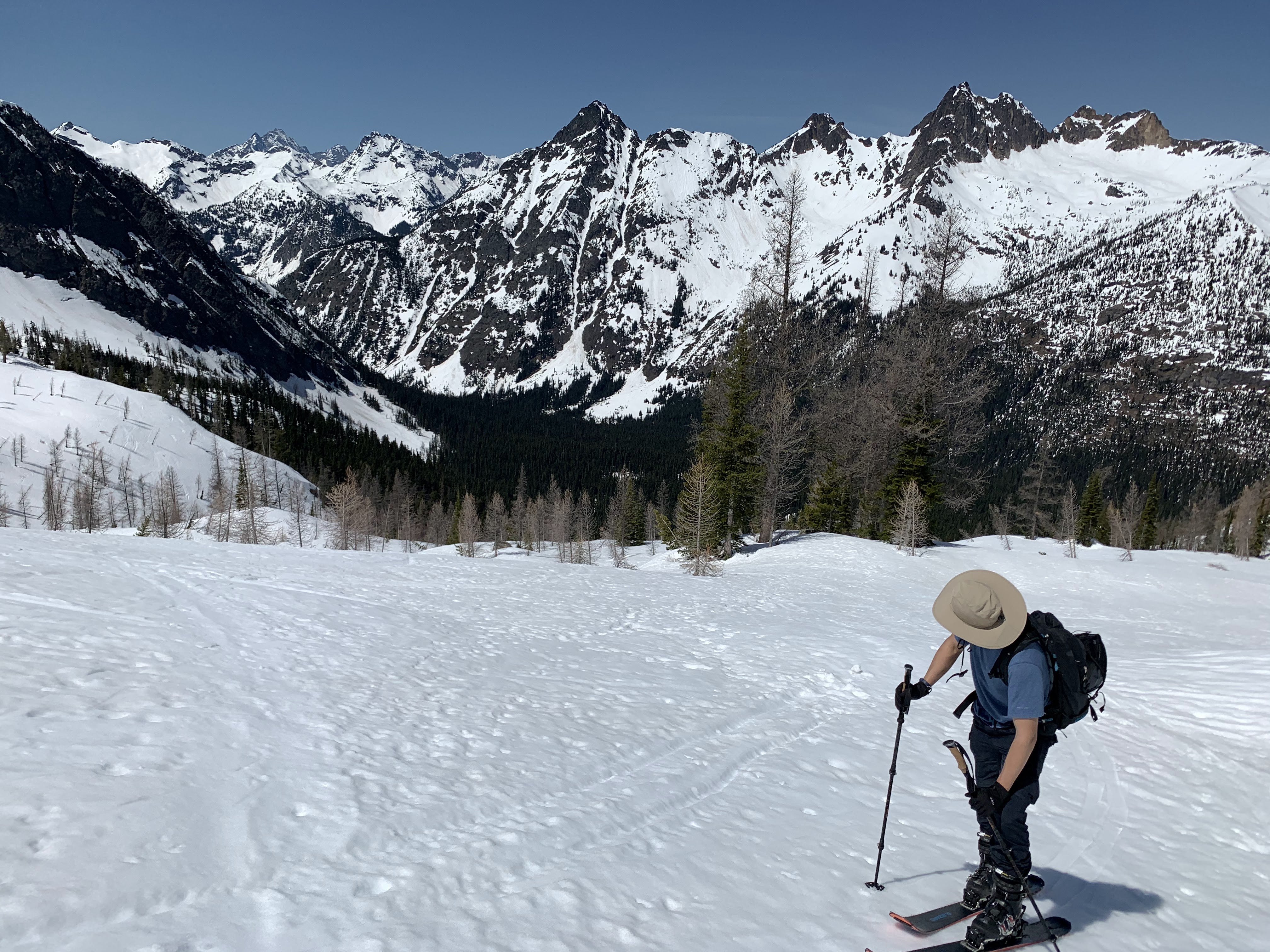
GPS location: 48.572225, -120.842828 Altitude: 1,965m
Camera: Apple iPhone 11 Focal:1.54 ISO:20 Shutter:9.67
Description: Hiking before road closure. A beautiful combination of colors. Photo credit: Kenny
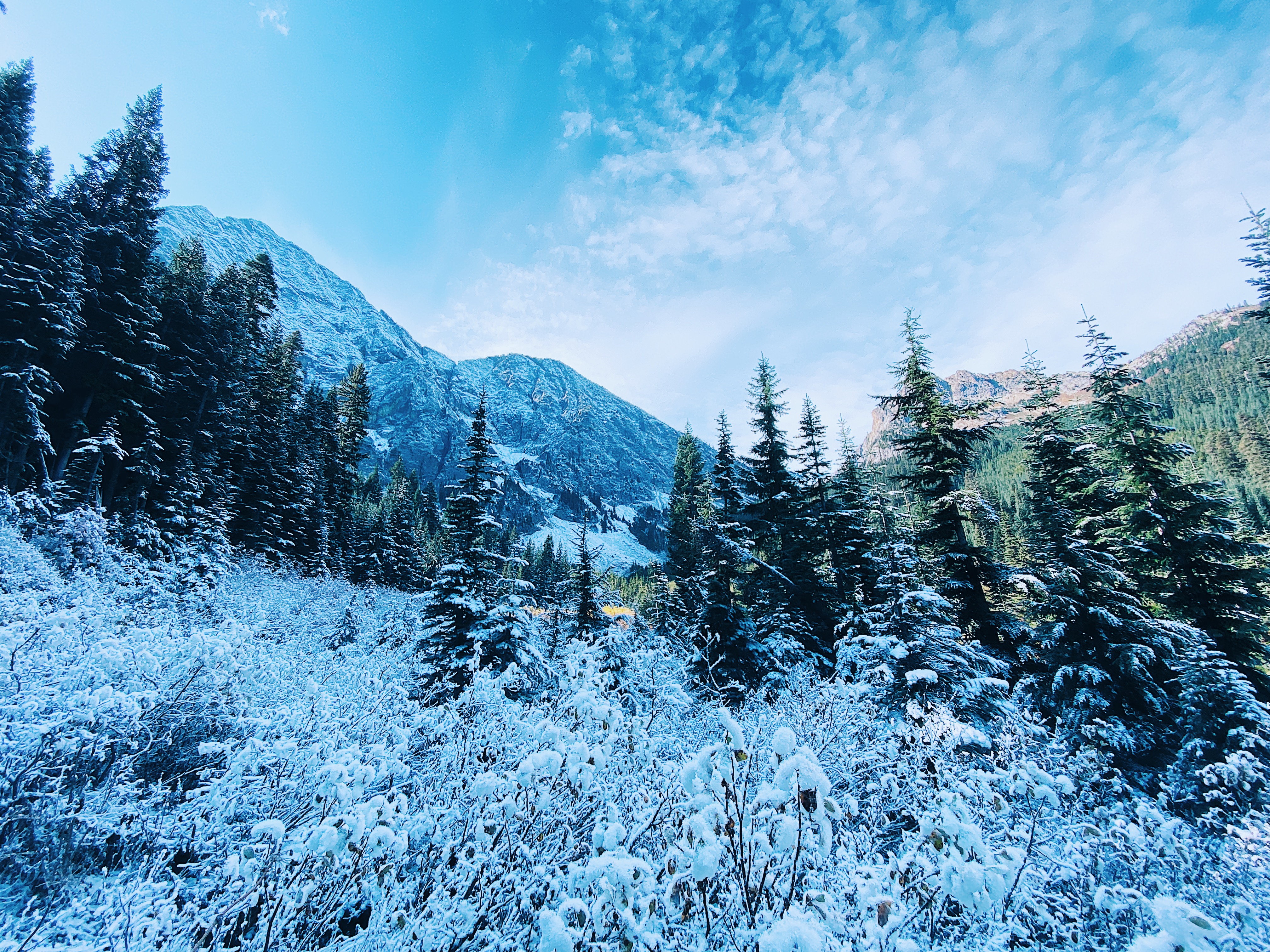
Captured on: 2021-10-08 11:48:54
GPS location: 48.575206, -120.819978 Altitude: 1,408m
Camera: Apple iPhone 11 Focal:1.54 ISO:20 Shutter:7.49
Description: In the early snow season, half of the mountain is white, half is green. Easy pass is in the middle. Photo credit: Kenny

Captured on: 2021-10-03 00:00:00
Camera:
Description: First organized a challenge.
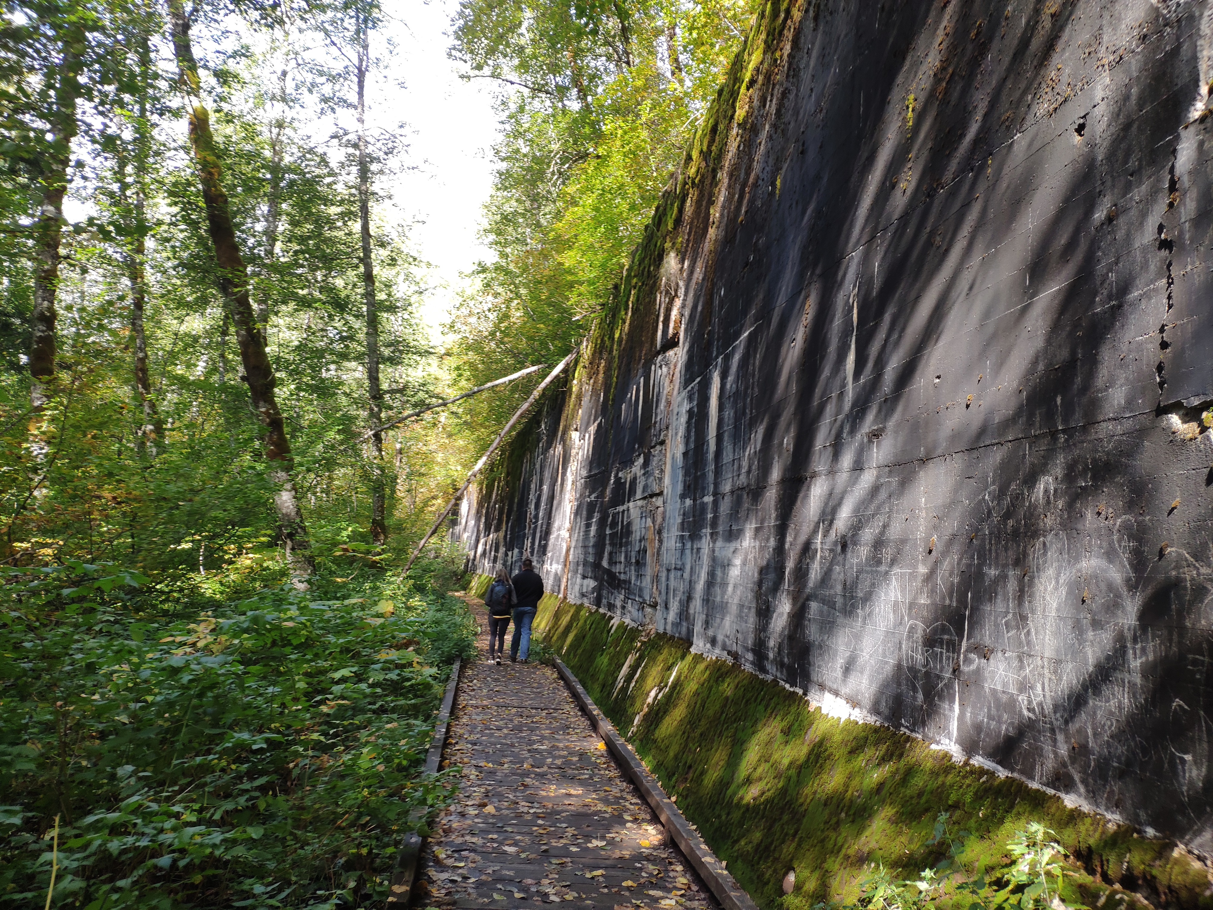
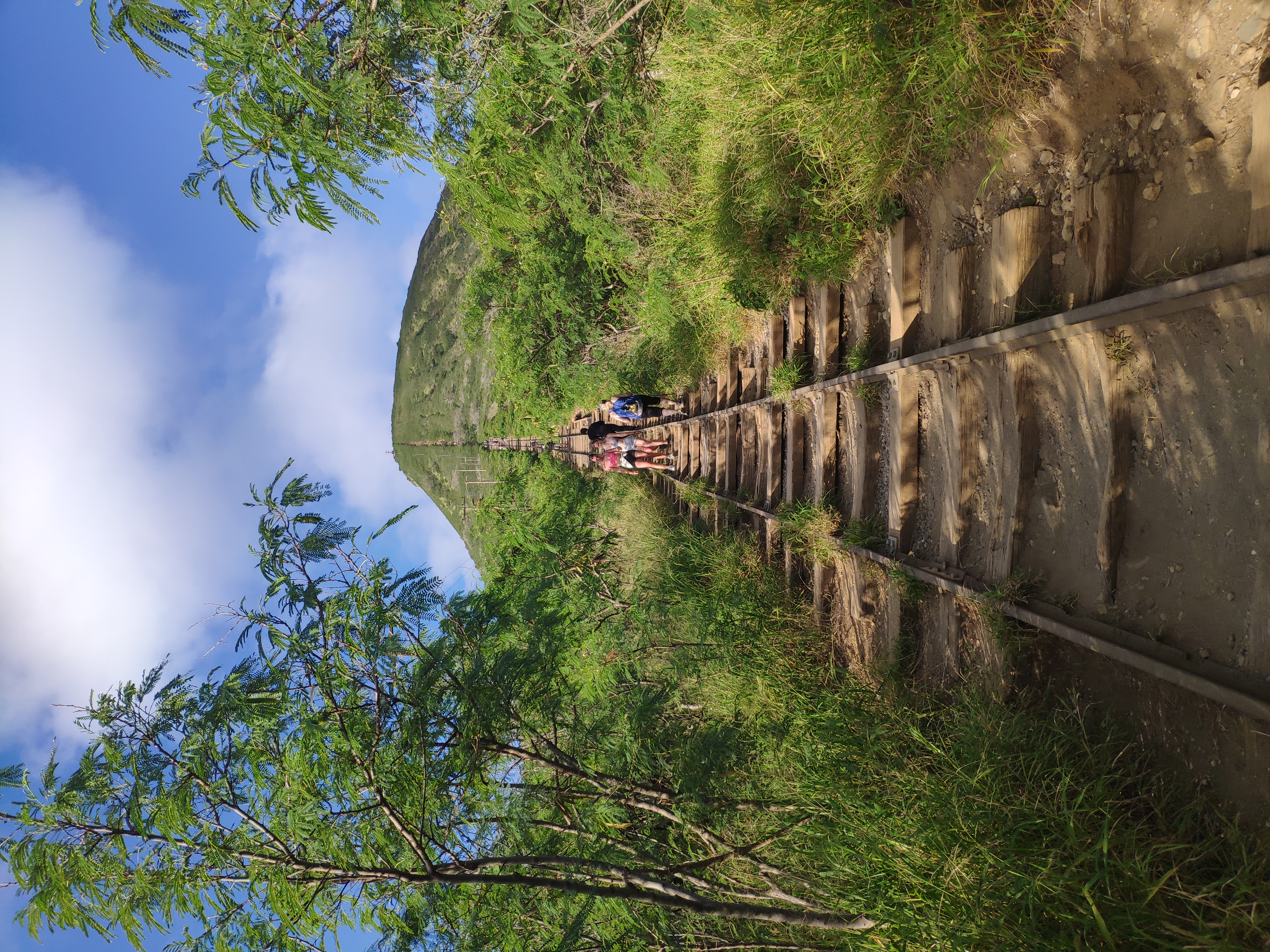
Captured on: 2021-10-02 11:09:11
GPS location: 47.715109, -121.167946 Altitude: 676m
Camera: Xiaomi Mi MIX 2S Focal:4.22 ISO:208 Shutter:6.64
Description: A fascinating walk through history alongside 100-year-old abandoned train tunnels and retaining wall.
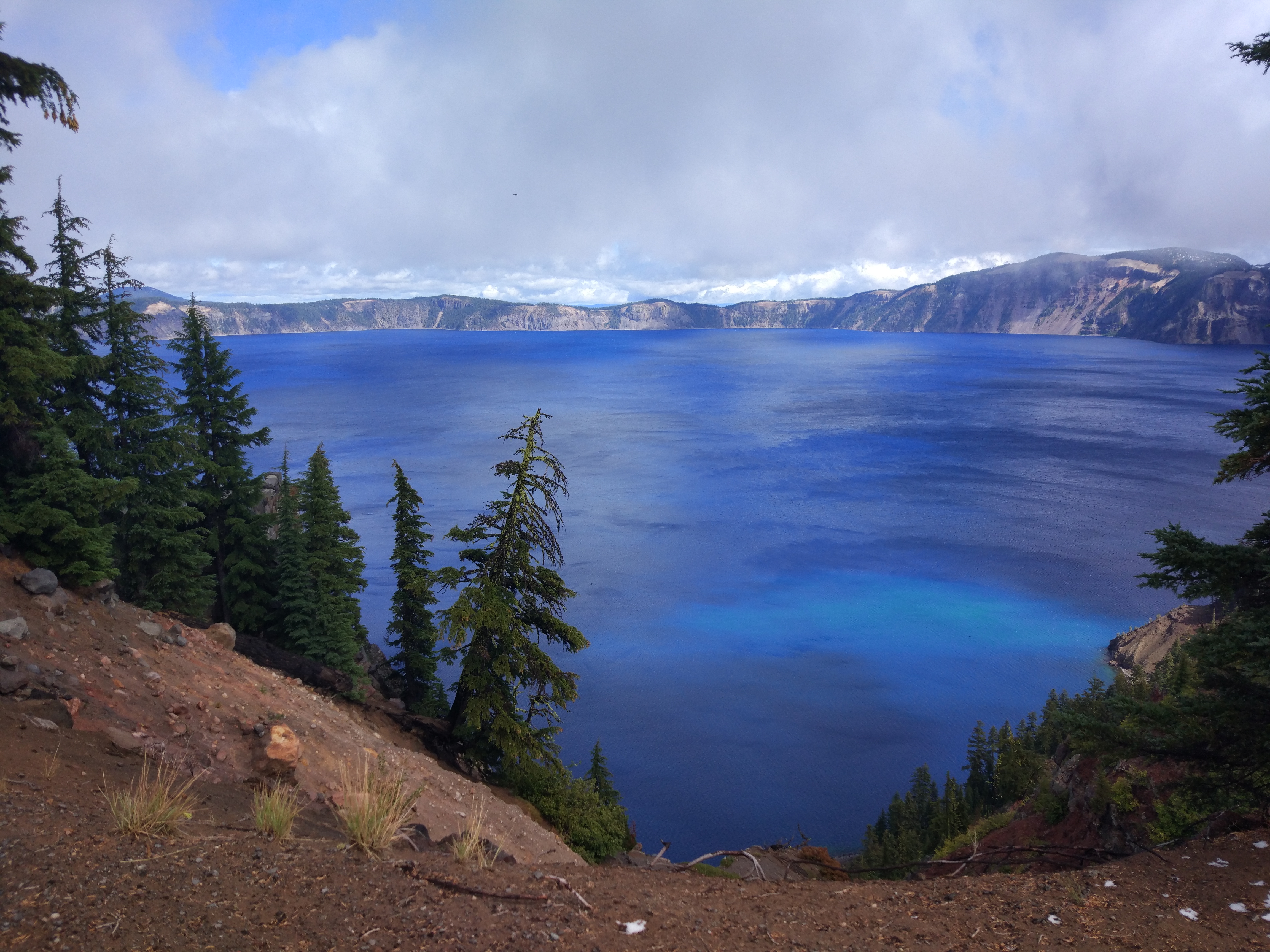
Captured on: 2021-09-18 12:59:08
GPS location: 42.911277, -122.143683 Altitude: 2,157m
Camera: Xiaomi MI 5 Focal:4.26 ISO:100 Shutter:9.80
Description: Drive all the way to Crater Lake to see this miracle color.
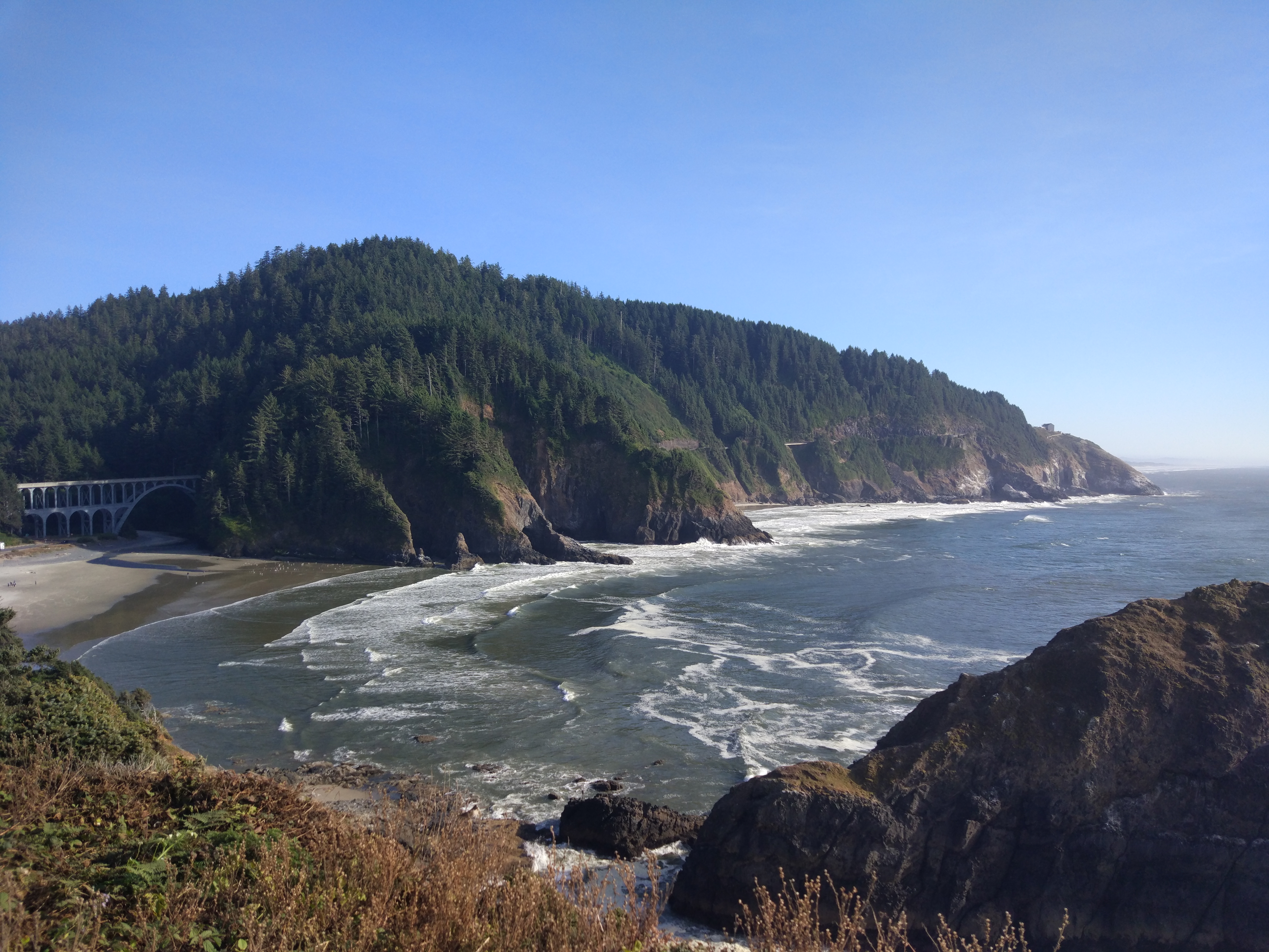
Captured on: 2021-09-16 16:55:30
GPS location: 44.137224, -124.128173 Altitude: 26m
Camera: Xiaomi MI 5 Focal:4.26 ISO:100 Shutter:9.57
Description: Great coastal view with all the elements: ocean, beach, cliff, forest, US Route 101 and Cape Creek Bridge
Captured on: 2021-09-09 18:39:00
GPS location: 17.960852, -67.038707
Camera: Apple iPhone 12 Pro Max Focal:7.50 ISO:80 Shutter:6.92
Description: Great trip of reef snorkeling and bioluminescence sea. Photo credit: Riley
Captured on: 2021-09-07 14:24:07
GPS location: 18.381934, -65.590848
Camera: Apple iPhone 11 Pro Focal:4.25 ISO:32 Shutter:11.96
Description: Excellent beach, challenging driving but a lot of fun. The only pity: my phone was dead after sea water leaking into the dry bag. Photo credit: Chang
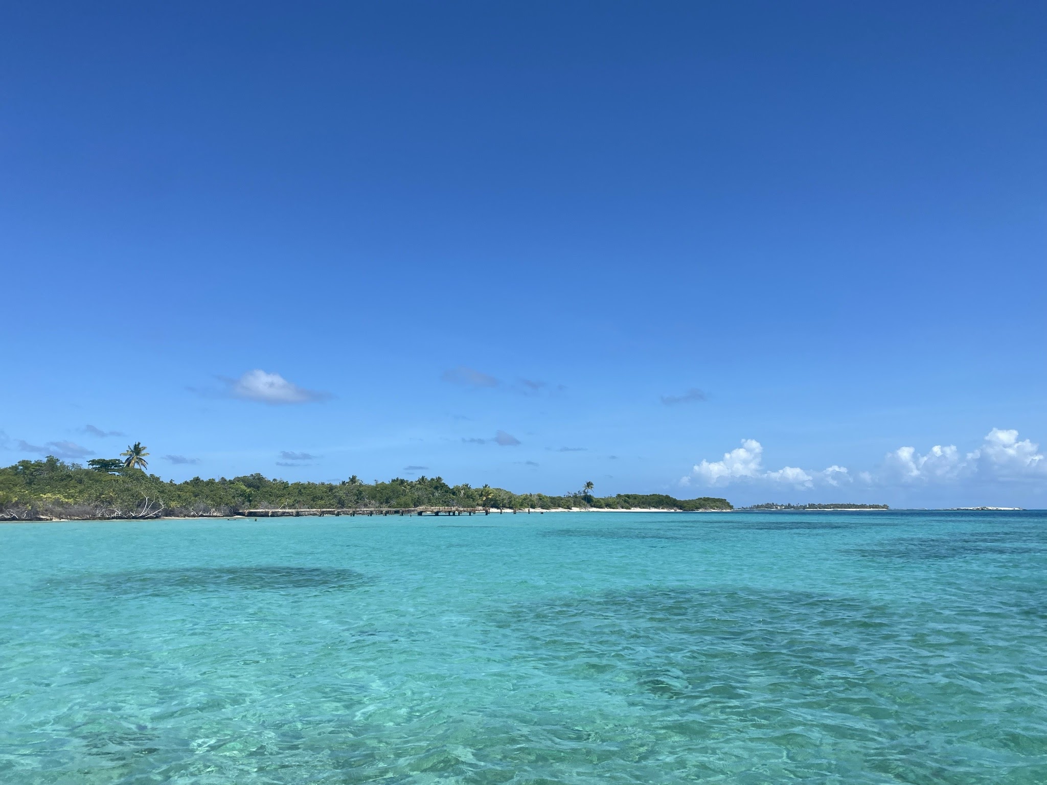
Captured on: 2021-09-07 14:23:52
GPS location: 18.345994, -65.570542
Camera: Apple iPhone 11 Pro Focal:4.25 ISO:32 Shutter:11.96
Description: A remote island only accessible by boat. Sunshine, sea with various colors, white beach and not many peoplemake a nice vocation.
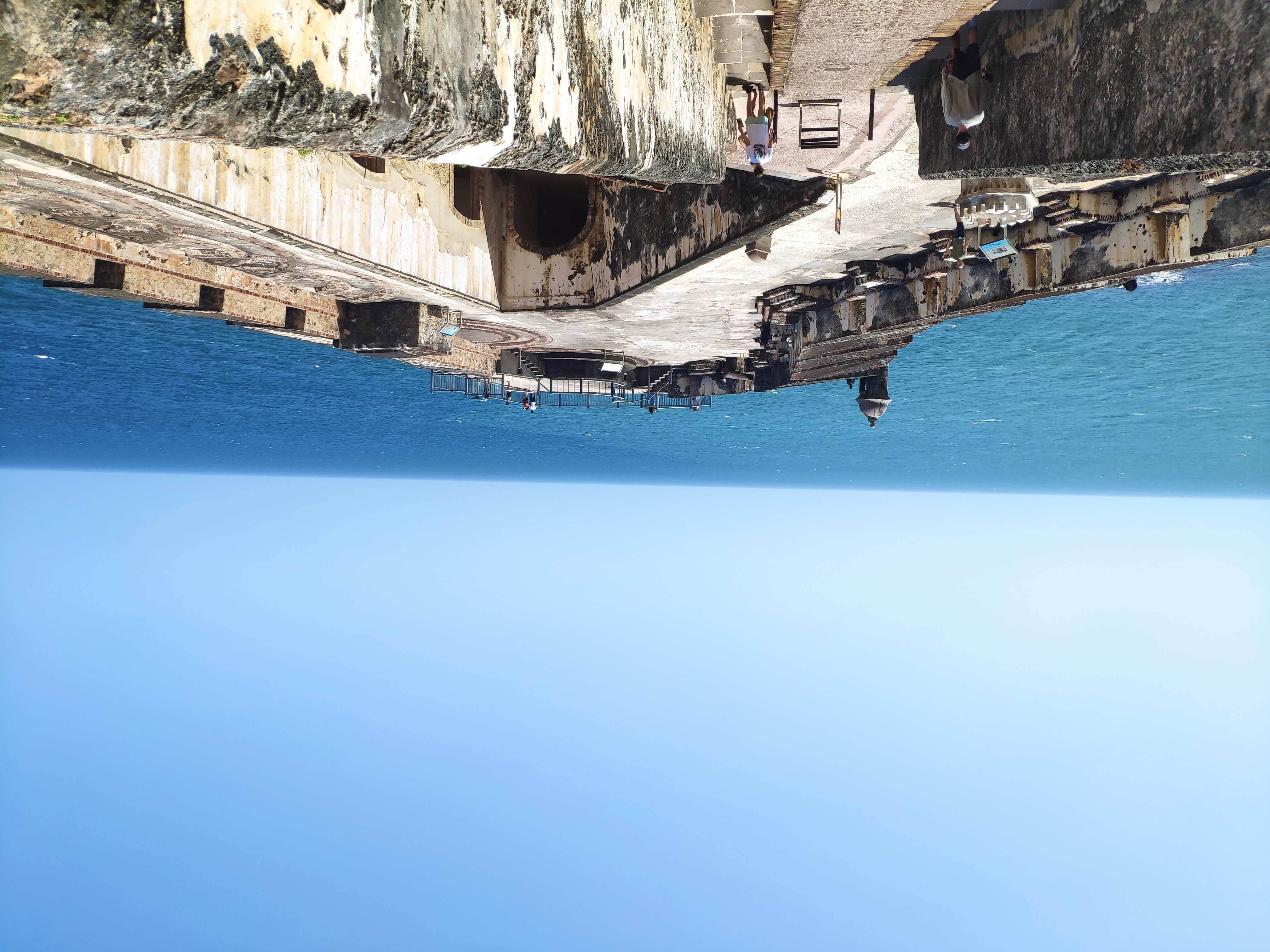
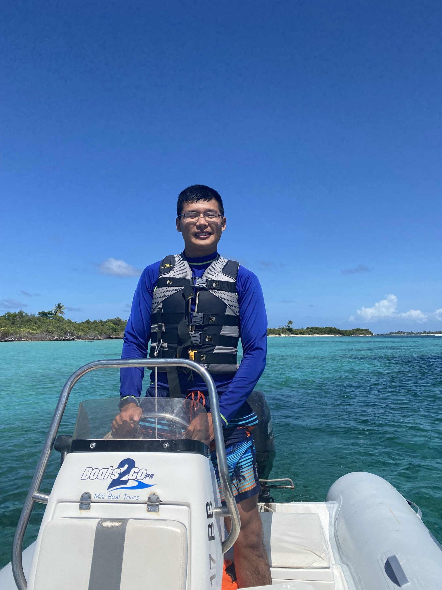
Captured on: 2021-09-05 14:21:27
GPS location: 18.471075, -66.124488
Camera: Xiaomi Mi MIX 2S Focal:4.22 ISO:100 Shutter:11.23
Description: An old fortification tells the story of the old San Juan.
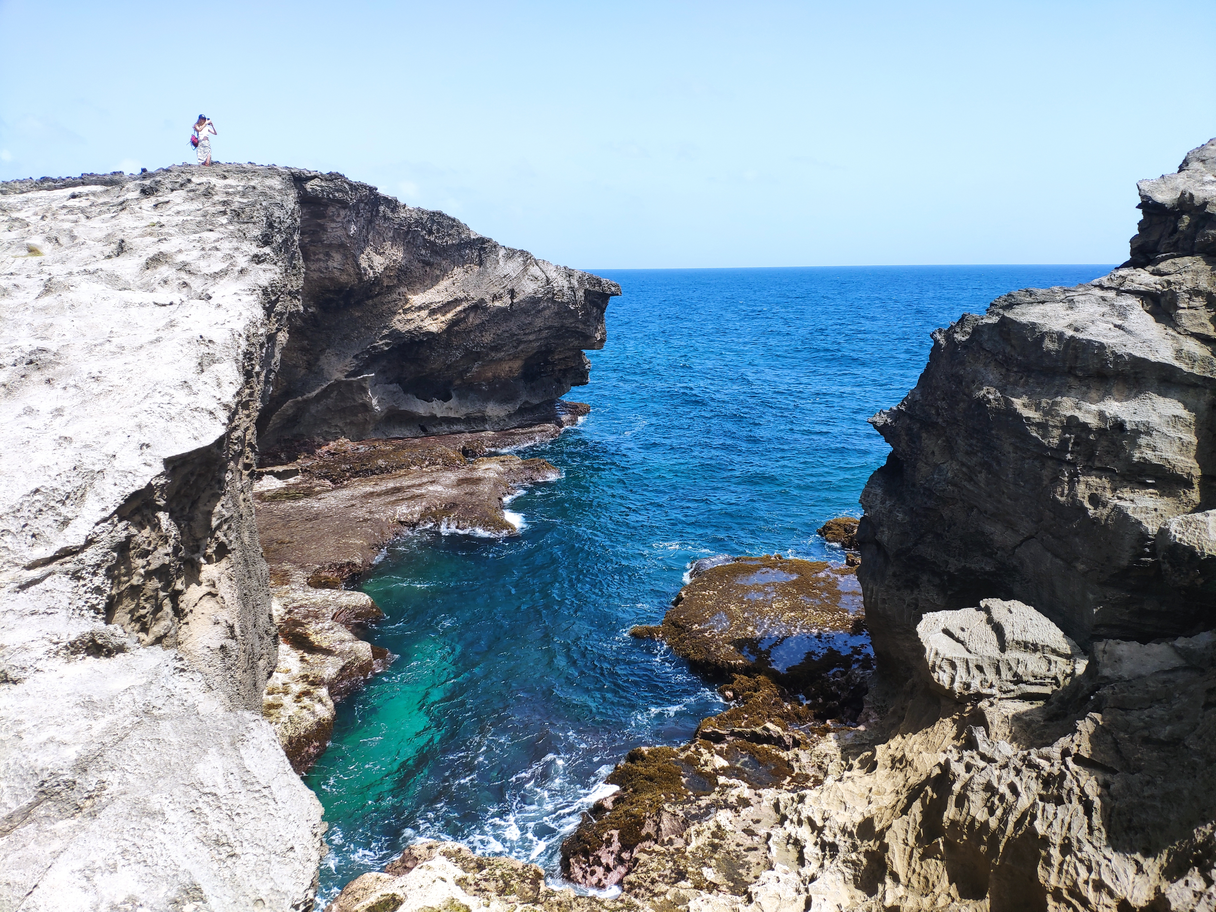
Captured on: 2021-09-05 10:30:21
GPS location: 18.492592, -66.641257
Camera: Xiaomi Mi MIX 2S Focal:4.22 ISO:100 Shutter:10.51
Description: A landmark cave with sapphire sea.

Captured on: 2021-08-28 14:32:23
GPS location: 37.992451, -122.972107 Altitude: 37m
Camera: Xiaomi Mi MIX 2S Focal:4.22 ISO:100 Shutter:11.30
Description: Best coastal view from a peaceful trail.

Captured on: 2021-08-28 12:19:01
GPS location: 37.996429, -123.021033 Altitude: 124m
Camera: Xiaomi Mi MIX 2S Focal:4.22 ISO:100 Shutter:10.72
Description: Hundreds of steps down to the lighthouse next to the beautiful sea

Captured on: 2021-08-23 17:55:04
Camera: Xiaomi Mi MIX 2S Focal:5.20 ISO:1,888 Shutter:5.32
Description: A certificate after five years' research assistantship on vascular image analysis. Thanks a lot to all the colleagues with me!
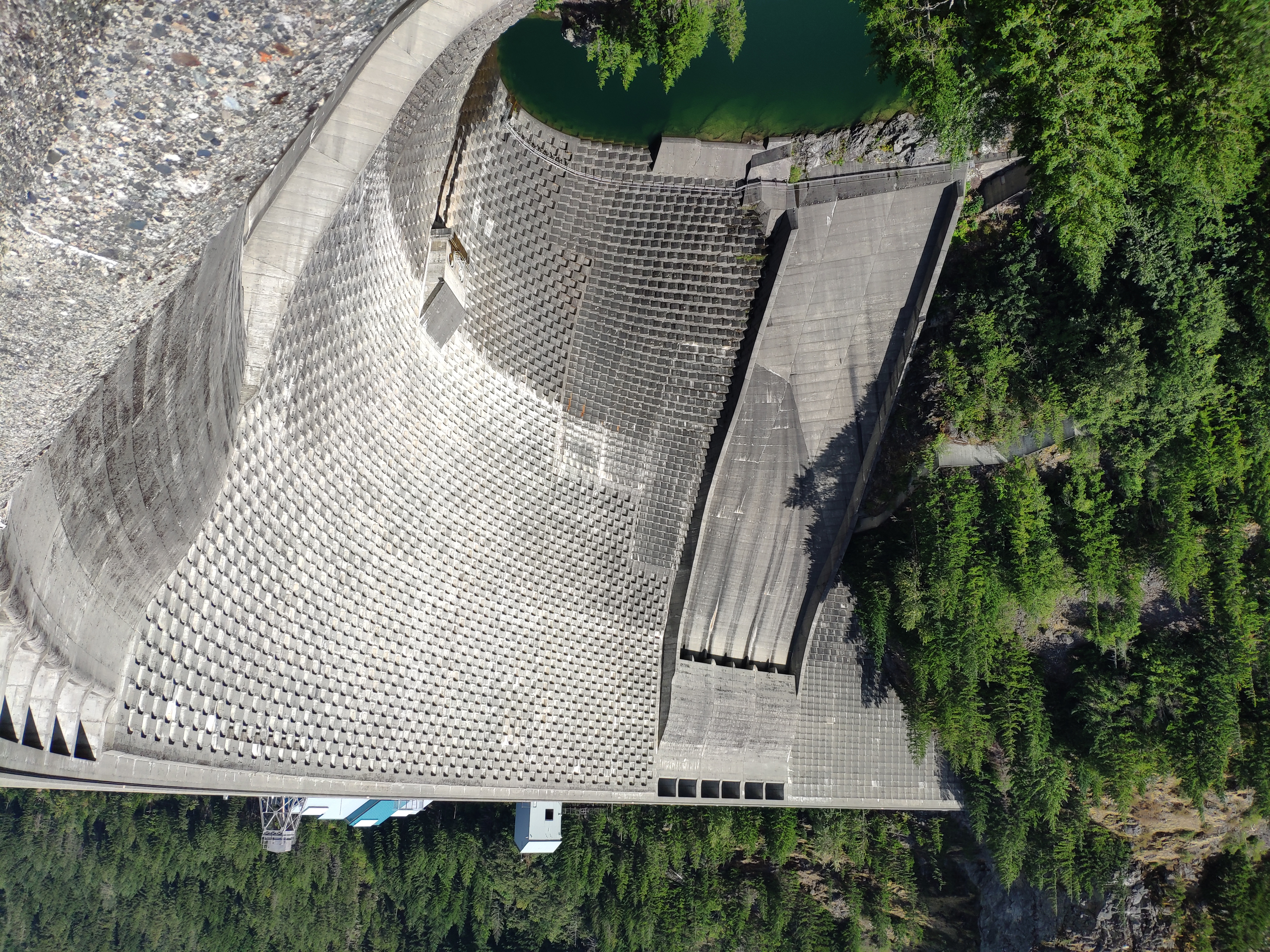
Captured on: 2021-08-22 14:18:07
GPS location: 48.730740, -121.067208 Altitude: 482m
Camera: Xiaomi Mi MIX 2S Focal:4.22 ISO:100 Shutter:10.68
Description: A beautifully built dam after a short trail.
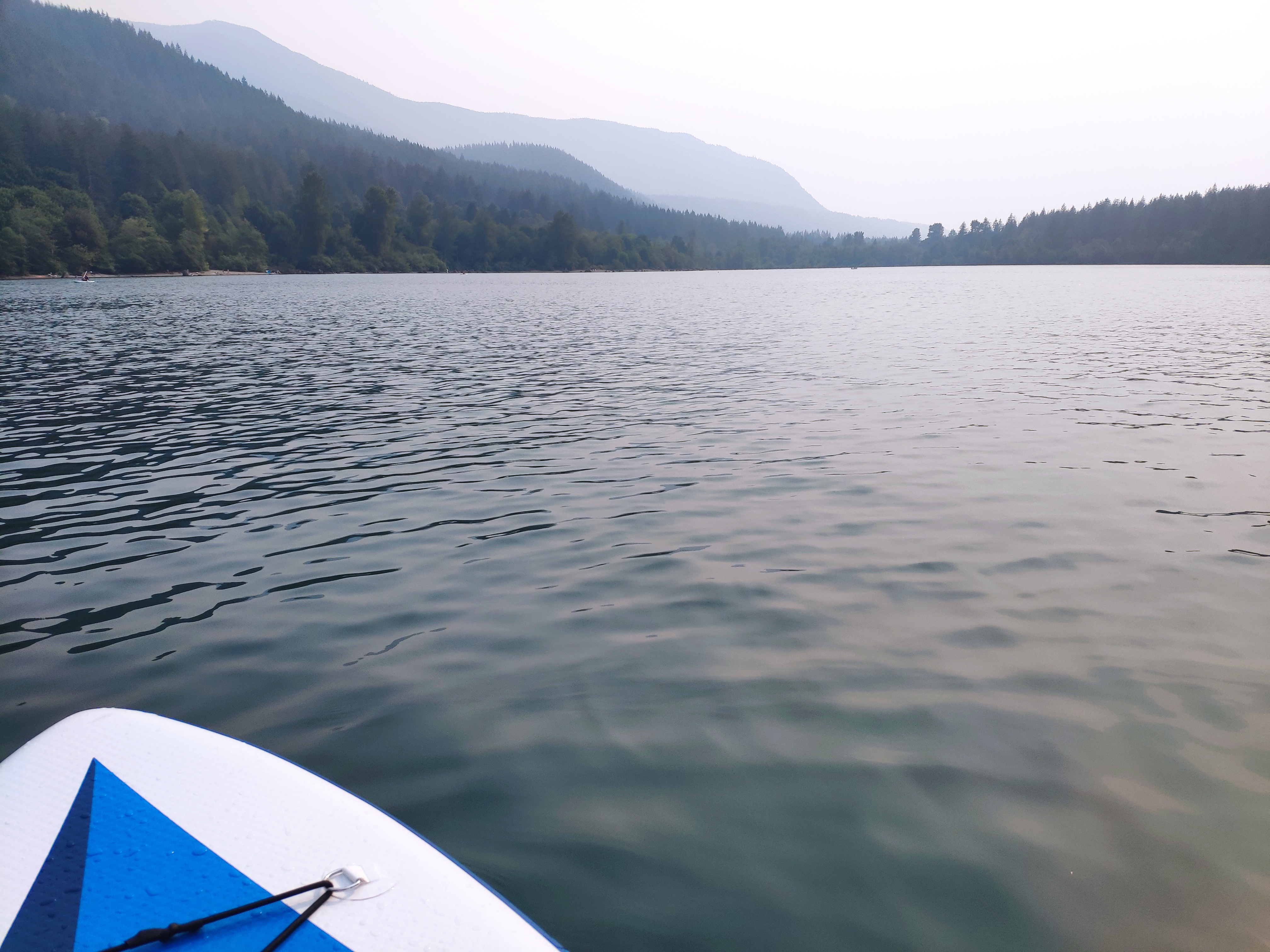
Captured on: 2021-08-13 16:33:15
GPS location: 47.433008, -121.771113 Altitude: 277m
Camera: Xiaomi Mi MIX 2S Focal:4.22 ISO:100 Shutter:11.02
Description: Finally after internship and dissertation defense, a memorable period of time without pressure. Paddle boarding becomes a new interest.
Captured on: 2021-08-06 20:31:56
Camera: Xiaomi MIX 2S Focal:4.22 ISO:616 Shutter:5.06
Description: A good summer internship in Genentech (sadly still virtually) a large biotech company with good culture and treats interns nicely.
Captured on: 2021-08-01 10:54:40
GPS location: 48.554976, -123.041417
Camera: Xiaomi MIX 2S Focal:4.22 ISO:100 Shutter:11.57
Description: Finally went to the San Juan Island after so many years in Seattle. A long ride with nice view.
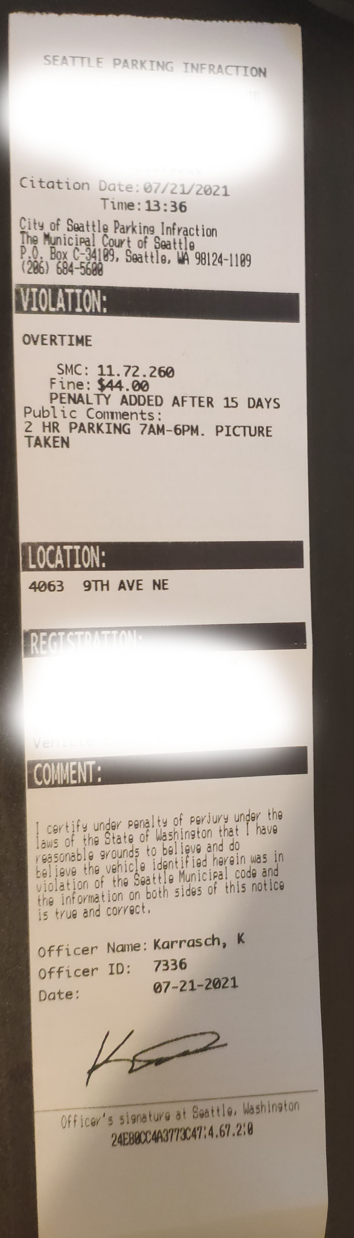
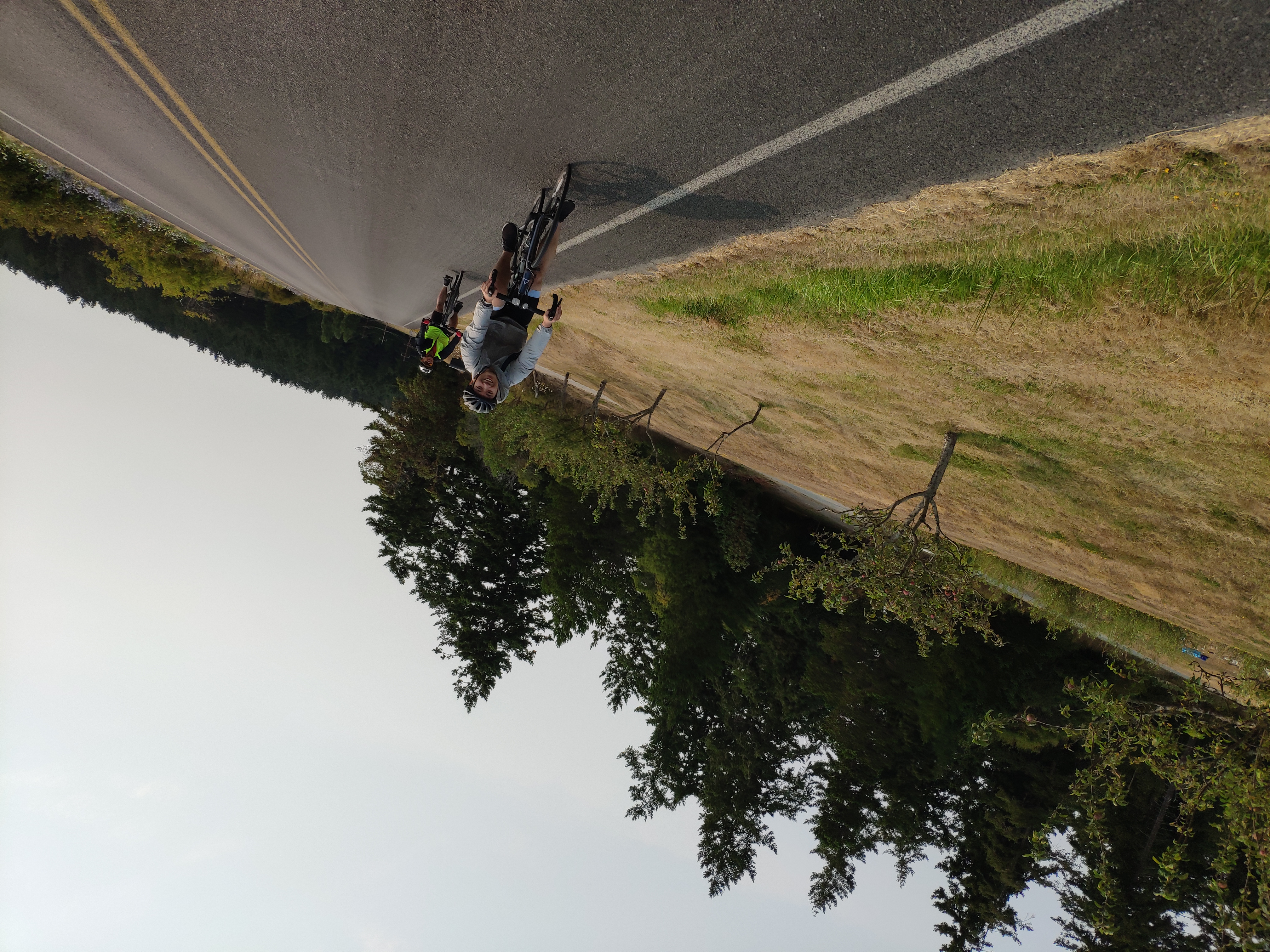
Captured on: 2021-07-26 16:36:24
GPS location: 47.657195, -122.318844
Camera: Xiaomi MIX 2S Focal:4.22 ISO:1,124 Shutter:4.64
Description: Park at night without noticing there is a 2 hour parking limit sign ahead. This is just steps away from home, got this ticket nearly under my eye.
Captured on: 2021-07-18 12:30:20
GPS location: 48.715977, -121.854538 Altitude: 1,608m
Camera: HUAWEI TAS-AL00 Focal:5.58 ISO:50 Shutter:29.90
Description: Mount Baker again. Photo credit: Chun
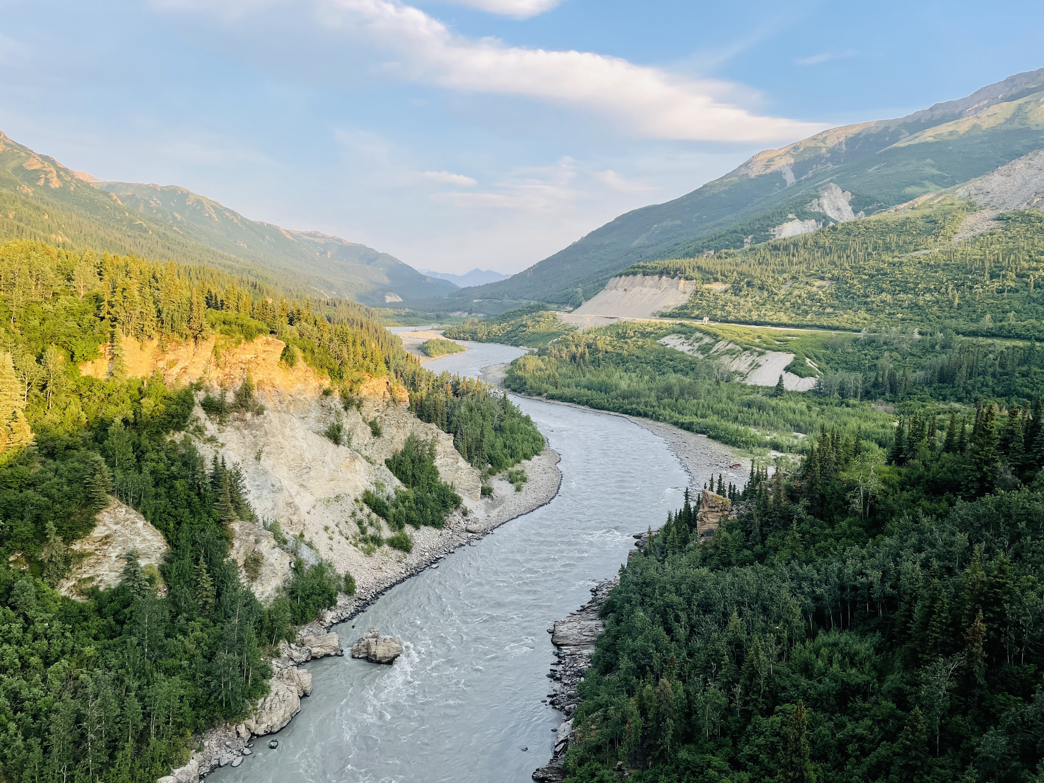
Captured on: 2021-07-04 22:16:11
GPS location: 63.802944, -148.934022 Altitude: 477m
Camera: Apple iPhone 12 Pro Focal:4.20 ISO:32 Shutter:9.50
Description: Golden light casts over green forest. Nenana river is the river we just drifted on. Photo credit: Mingwei

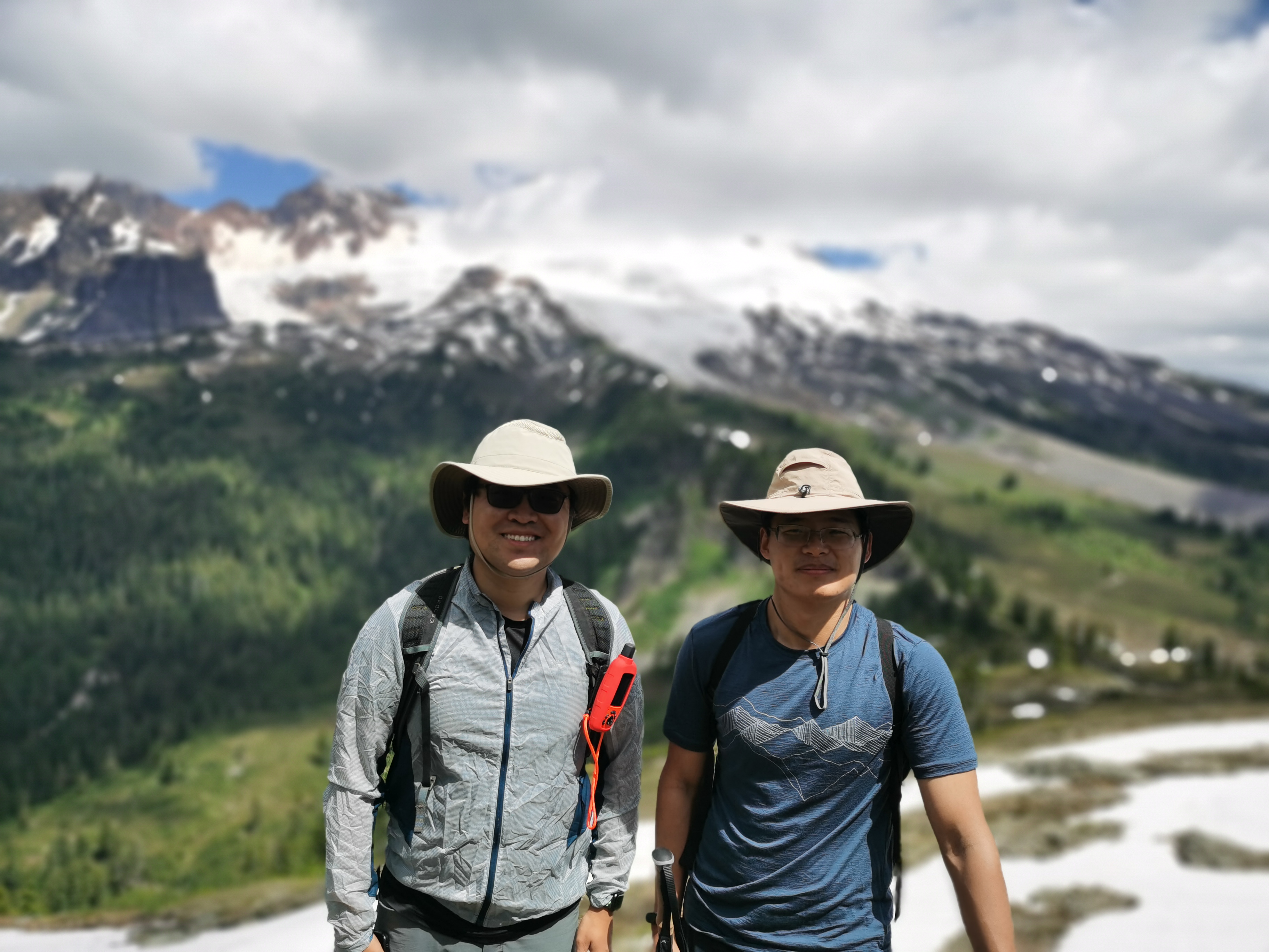
Captured on: 2021-07-04 15:36:19
GPS location: 63.608853, -149.584853 Altitude: 910m
Camera: Apple iPhone 12 Pro Focal:4.20 ISO:32 Shutter:12.12
Description: 8 hours 42 miles mountain bike riding, but worth it. Photo credit: Mingwei

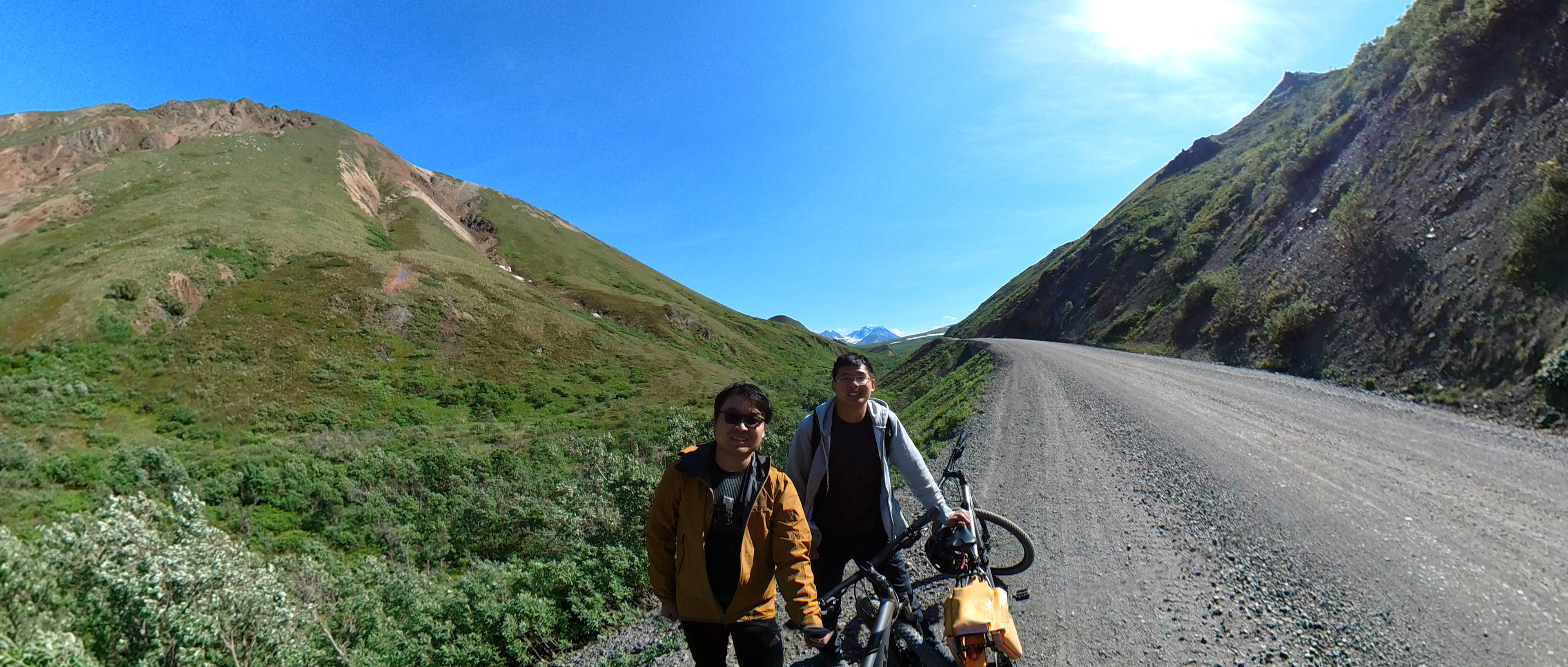
Captured on: 2021-07-04 14:52:14
GPS location: 63.657047, -149.570511 Altitude: 799m
Camera: Apple iPhone 12 Pro Focal:6.00 ISO:25 Shutter:11.09
Description: It is a good idea to bike the Denali, so you won't miss any detail in this beautiful park. You will notice new beauty with your every movement. Photo credit: Mingwei

Captured on: 2021-07-03 14:00:00
GPS location: 63.801748, -148.933278
Description: The moment before a big wave spalshed on us when we were drifting on the Nenana River. Photo credit: Mingwei
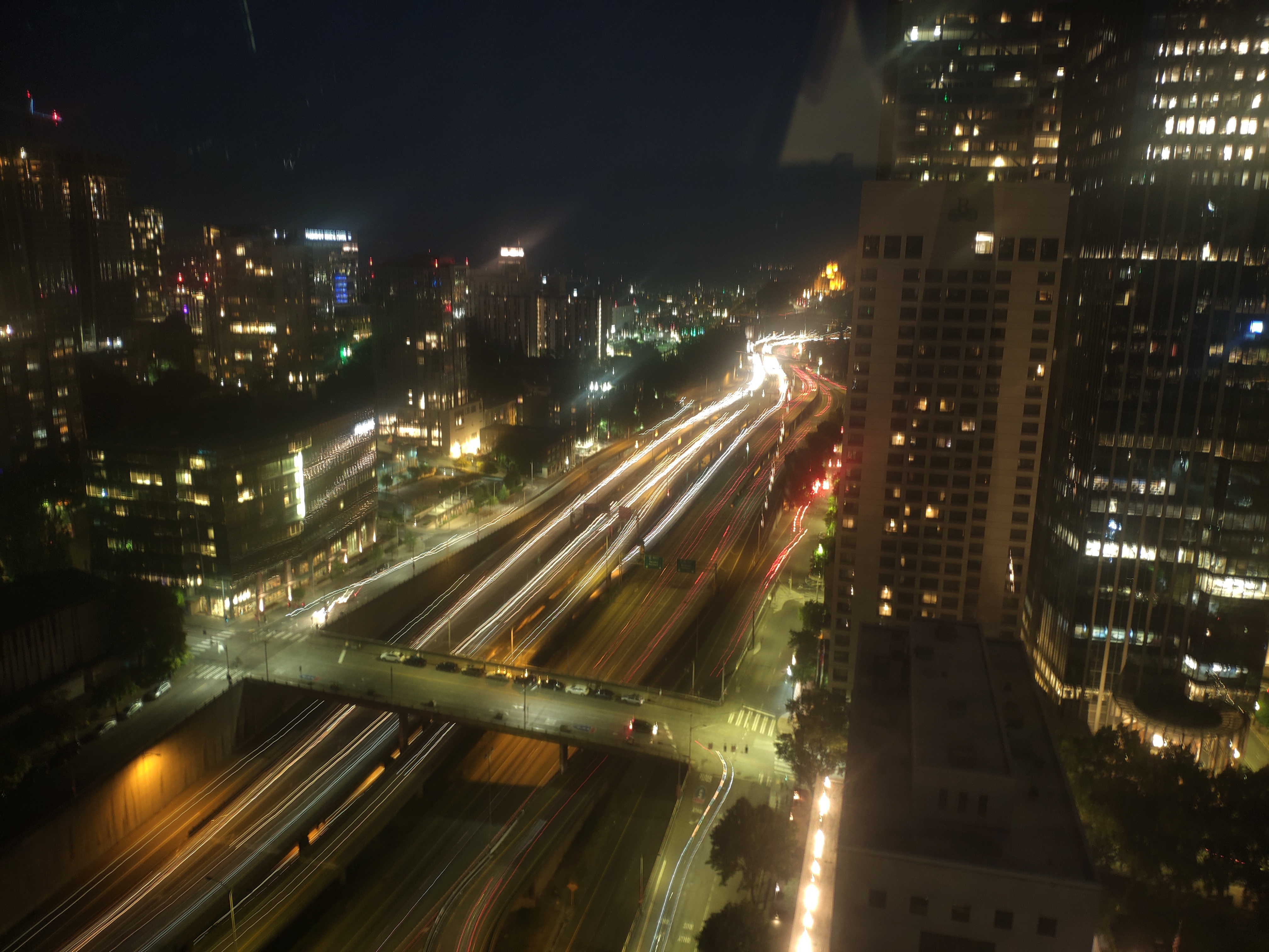
Captured on: 2021-06-28 22:20:38
GPS location: 47.608114, -122.332082
Camera: Xiaomi MIX 2S Focal:4.22 ISO:119 Shutter:-3.00
Description: Long expore of traffic lights. No AC at home. Never thought I used the free night certificate in Seattle in this once-in-a-thousand-year heat wave.
Captured on: 2021-06-28 15:32:17
Camera: Screenshot
Description: Can you believe this is Seattle?

Captured on: 2021-05-31 10:27:51
GPS location: 61.788498, -148.43907 Altitude: 302m
Camera: Xiaomi MIX 2S Focal:4.22 ISO:100 Shutter:11.25
Description: A view point on Glenn Hwy. Nice mountain and river view.
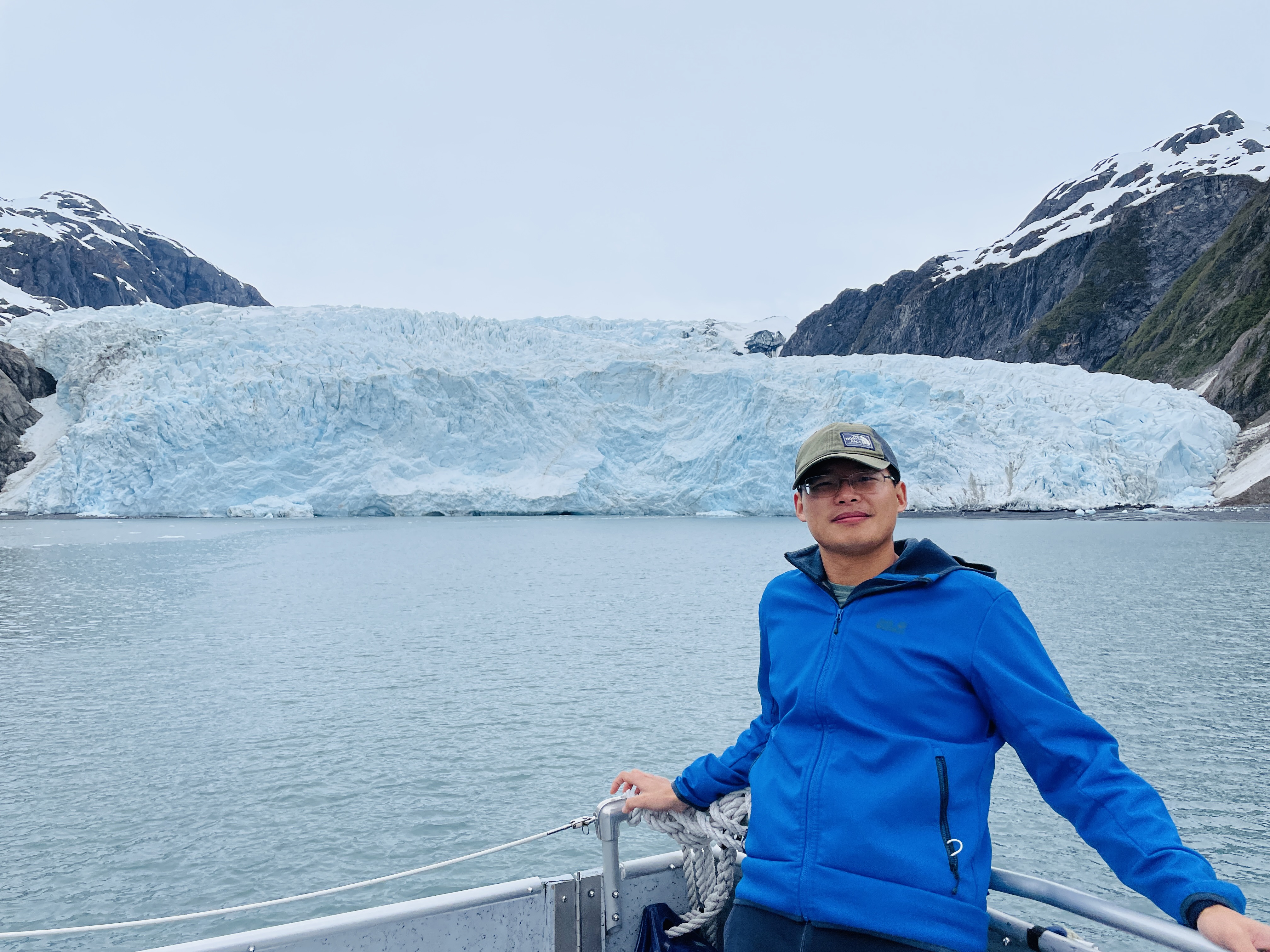
Captured on: 2021-05-30 13:19:24
GPS location: 59.849961, -149.85765 Altitude: 7m
Camera: Apple iPhone 12 Pro Focal:4.20 ISO:32 Shutter:13.54
Description: Never know whether I can see this glacier again with global warming. Photo credit: Mingwei
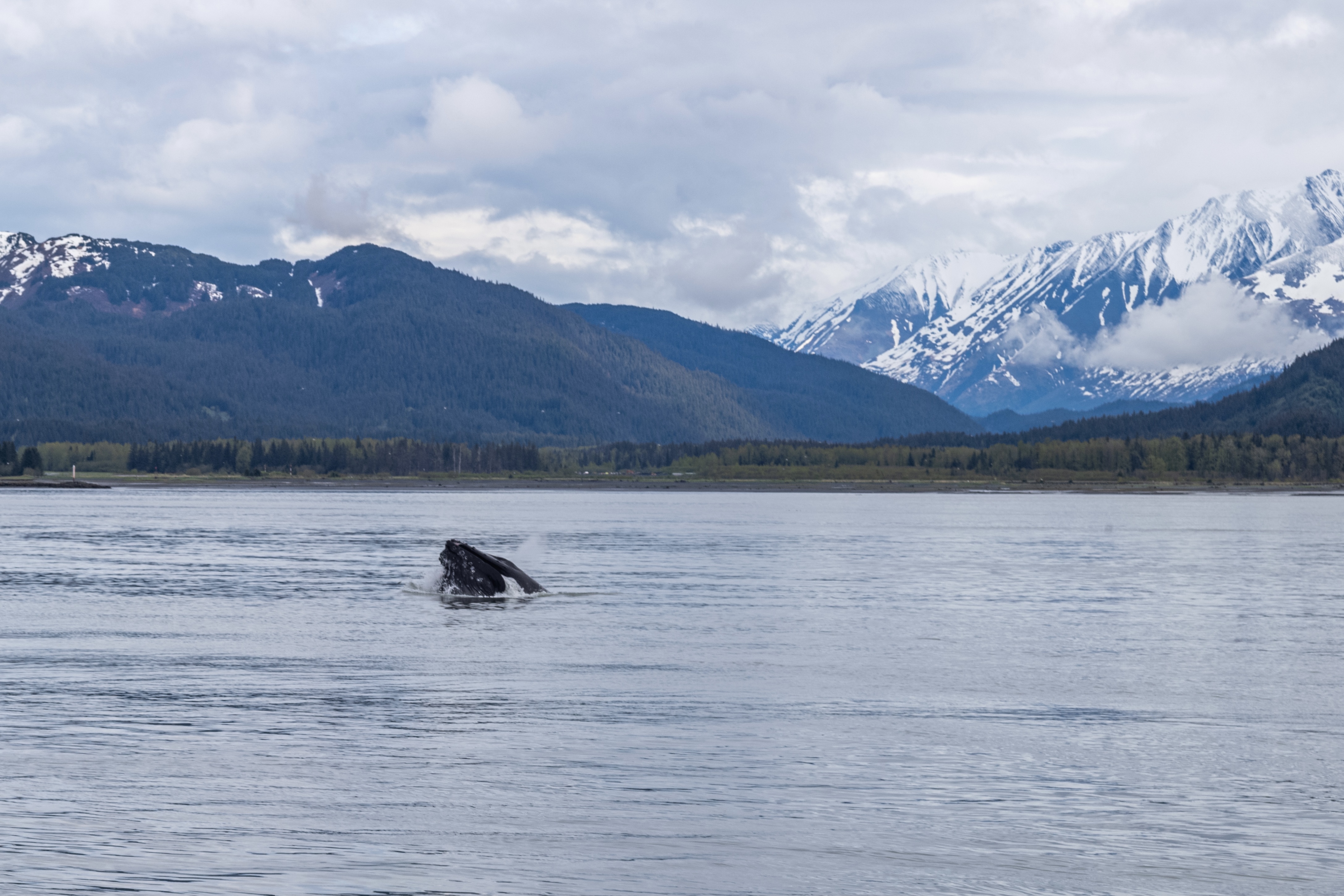
Captured on: 2021-05-30 08:18:16
GPS location: 60.060541, -149.402265
Camera: Leica Camera AG LEICA M10 Focal:90.00 ISO:200 Shutter:8.45
Description: An exciting voyage to watch wild life in Alaska. Quite lucky to see whales, seals, bears, otters, etc. Photo credit: Mingwei
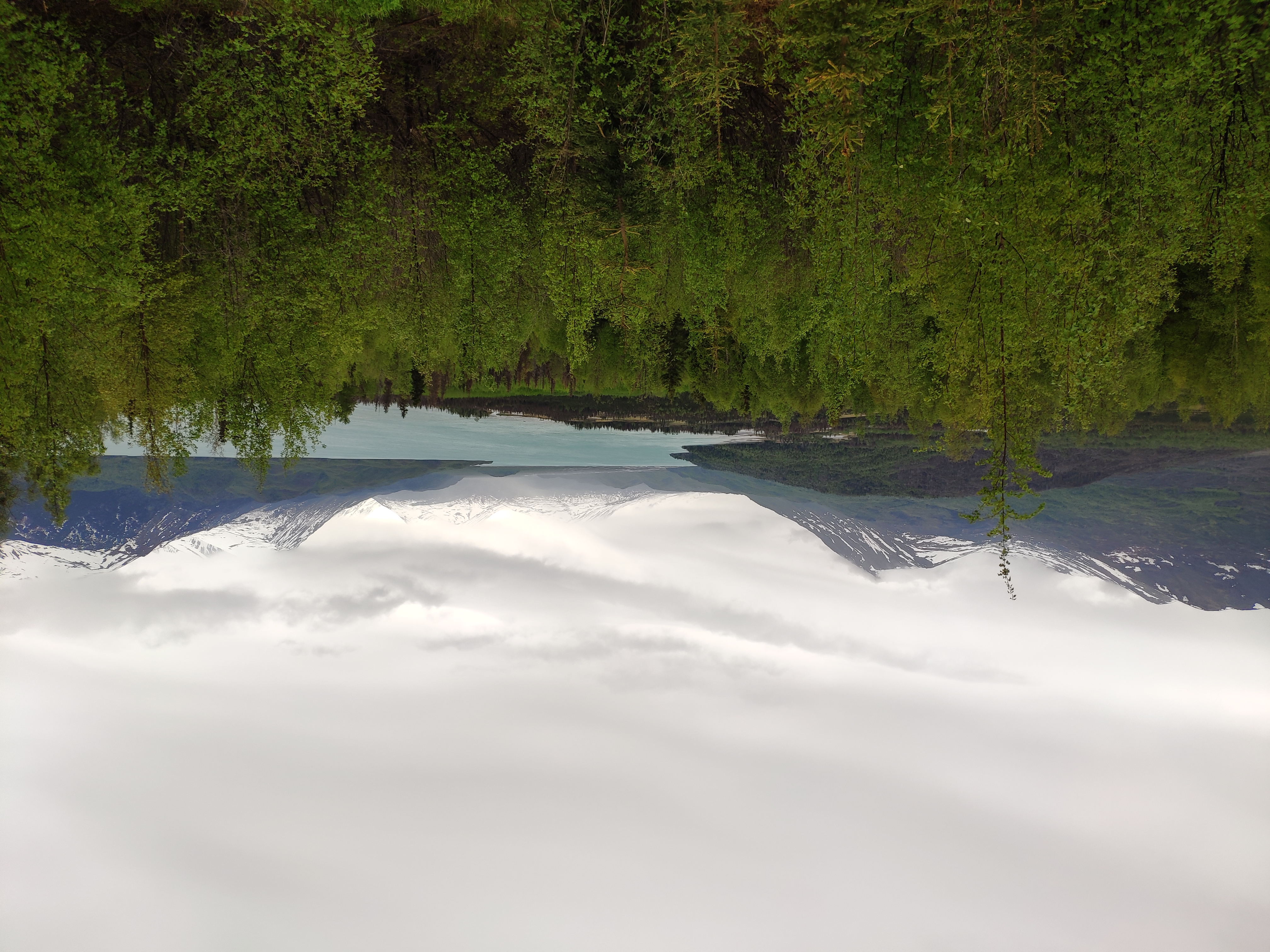
Captured on: 2021-05-29 14:19:55
GPS location: 60.459048, -150.2059 Altitude: 90m
Camera: Xiaomi MIX 2S Focal:4.22 ISO:100 Shutter:9.63
Description: Nice lake color due to melted glacier water. A less-know attraction. We just met a black bear when stopped by to take a photo.
Captured on: 2021-05-09 17:24:44
GPS location: 21.280928, -157.691881 Altitude: 74m
Camera: Xiaomi MIX 2S Focal:4.22 ISO:100 Shutter:10.06
Description: Steep hike on an abandoned railroad track to Koko Crater, with dramatic ocean & city views. Difficulty increases if we are about to catch a flight in a few hours.

Captured on: 2021-05-08 14:13:04
GPS location: 21.259813, -157.811804 Altitude: 203m
Camera: Xiaomi MIX 2S Focal:4.22 ISO:100 Shutter:12.30
Description: Best view point to Honolulu. Despite of being deeply developed for tourism, still a charming place for enjoying the sea.
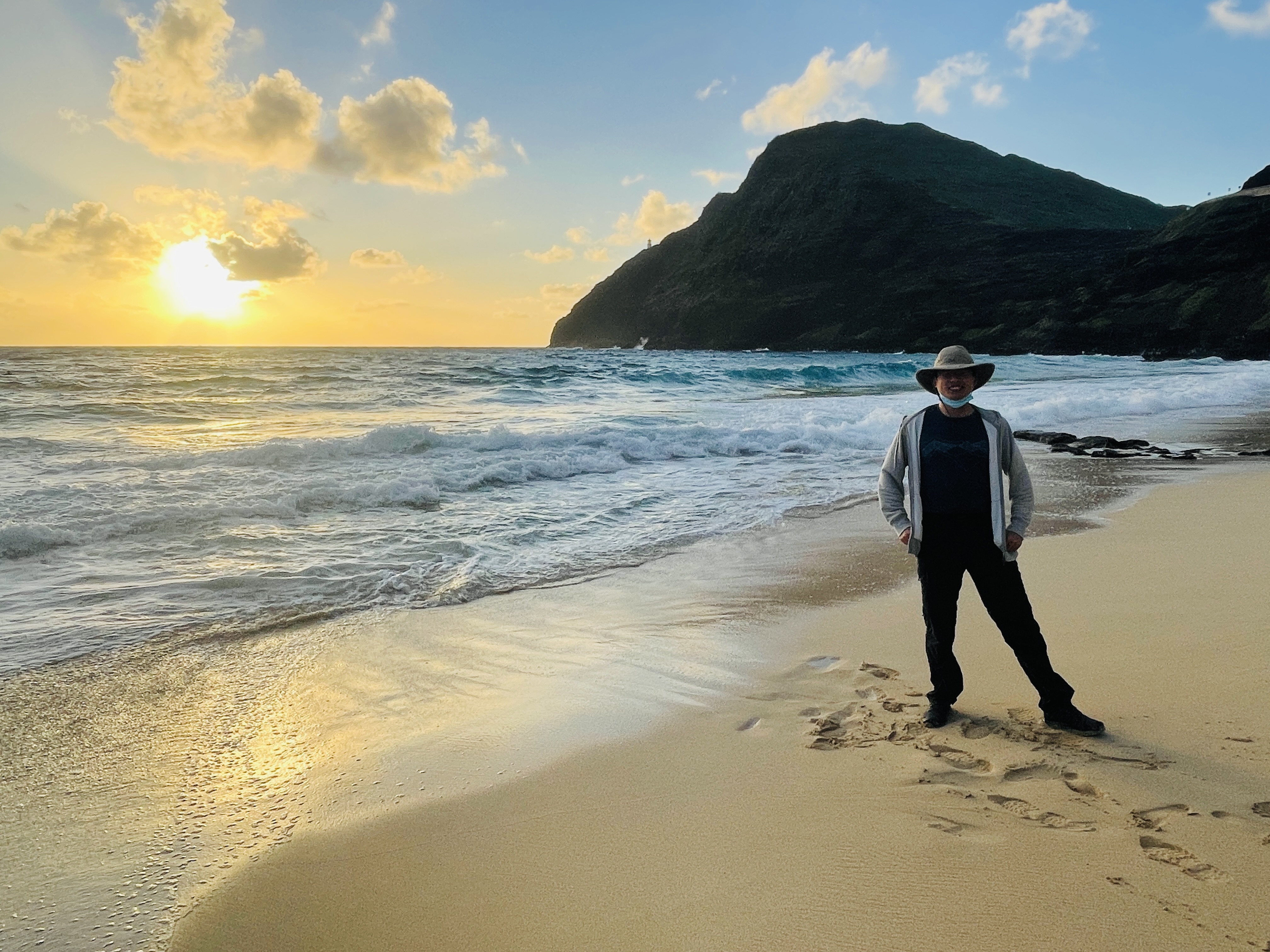
Captured on: 2021-05-08 06:18:08
GPS location: 21.311486, -157.660308 Altitude: 15m
Camera: Apple iPhone 12 Pro Focal:1.54 ISO:25 Shutter:9.91
Description: Great place to see sun rise and people surfing. Had to get up so early in this crazy fully-packed two-day trip to Hawaii. Photo credit: Mingwei
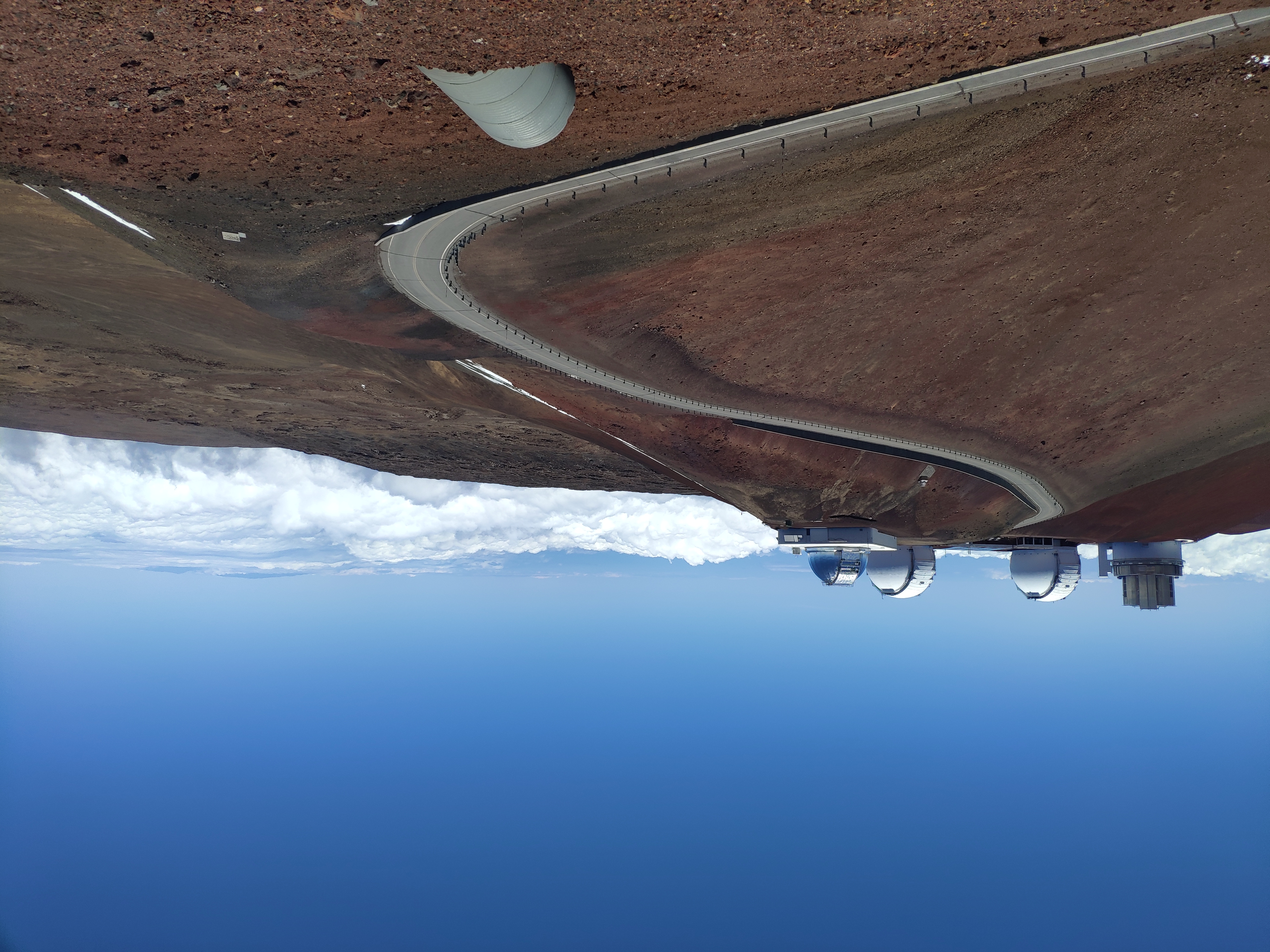
Captured on: 2021-04-25 13:02:49
GPS location: 19.825341, -155.469083 Altitude: 4,209m
Camera: Xiaomi MIX 2S Focal:4.22 ISO:100 Shutter:11.96
Description: Hard to imagine there is snow in Hawai'i. Rising from sea level is so quick that visitors have to stop in the midway for half an hour to adjust to the air pressure.
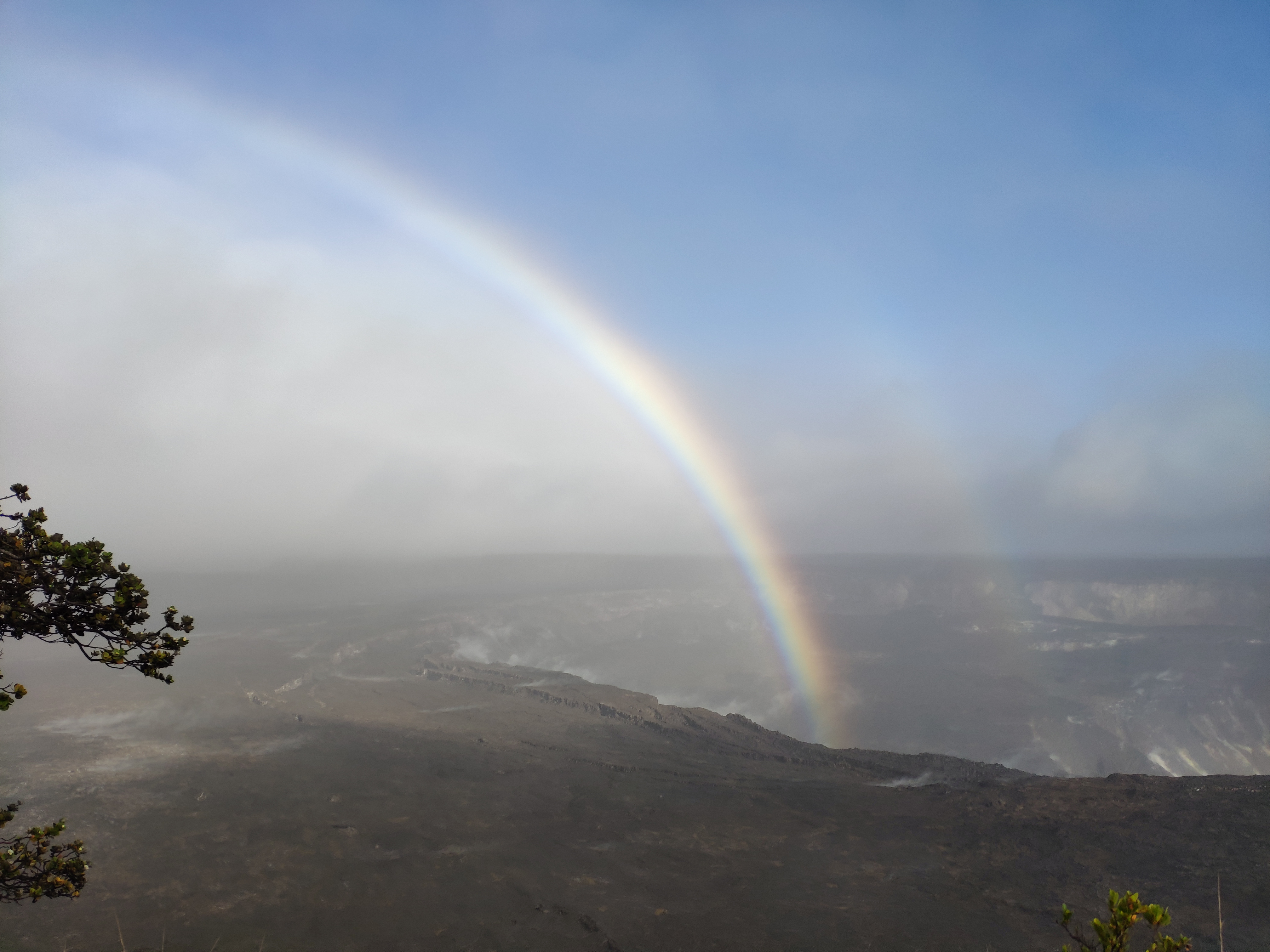
Captured on: 2021-04-24 17:21:45
GPS location: 19.423136, -155.284046 Altitude: 1,257m
Camera: Xiaomi MIX 2S Focal:4.22 ISO:100 Shutter:10.64
Description: A nice rainbow rising from the crater after a shower. No lava this time.
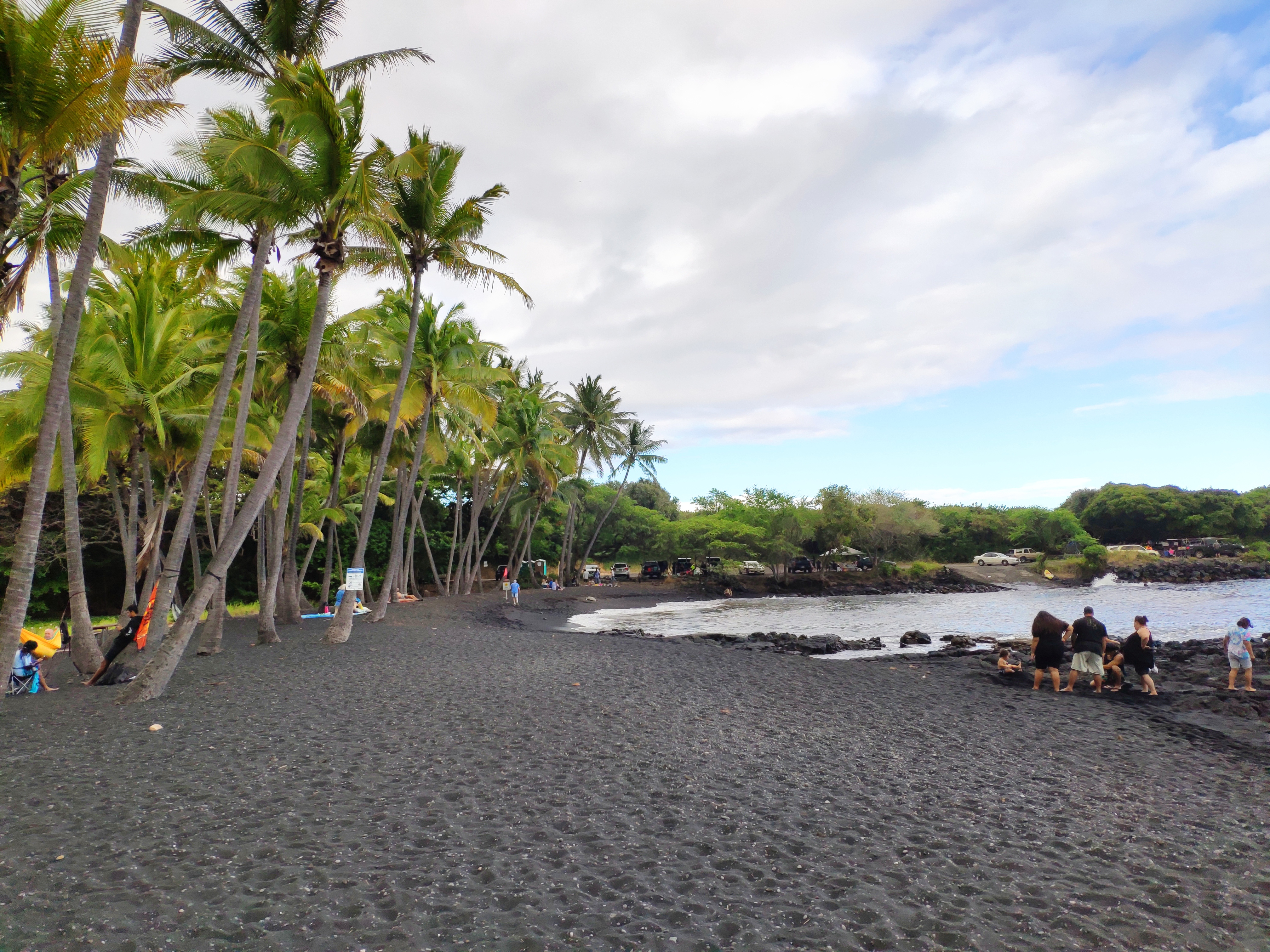
Captured on: 2021-04-24 16:12:31
GPS location: 19.136145, -155.504347 Altitude: 20m
Camera: Xiaomi MIX 2S Focal:4.22 ISO:100 Shutter:10.42
Description: Beach with black sand and green sea turtle.
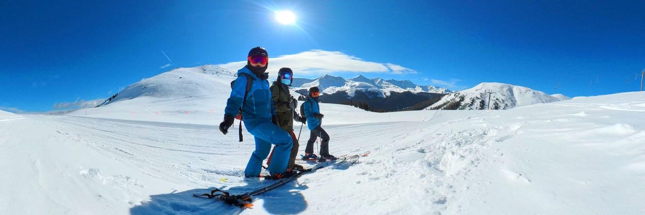
Captured on: 2021-03-28 08:41:34
GPS location: 39.470419, -106.157608 Altitude: 3,747m
Camera: Arashi Vision Insta360 ONE X2
Description: Snow view at the top of the mountain captured by Insta360. Photo credit: Mingwei
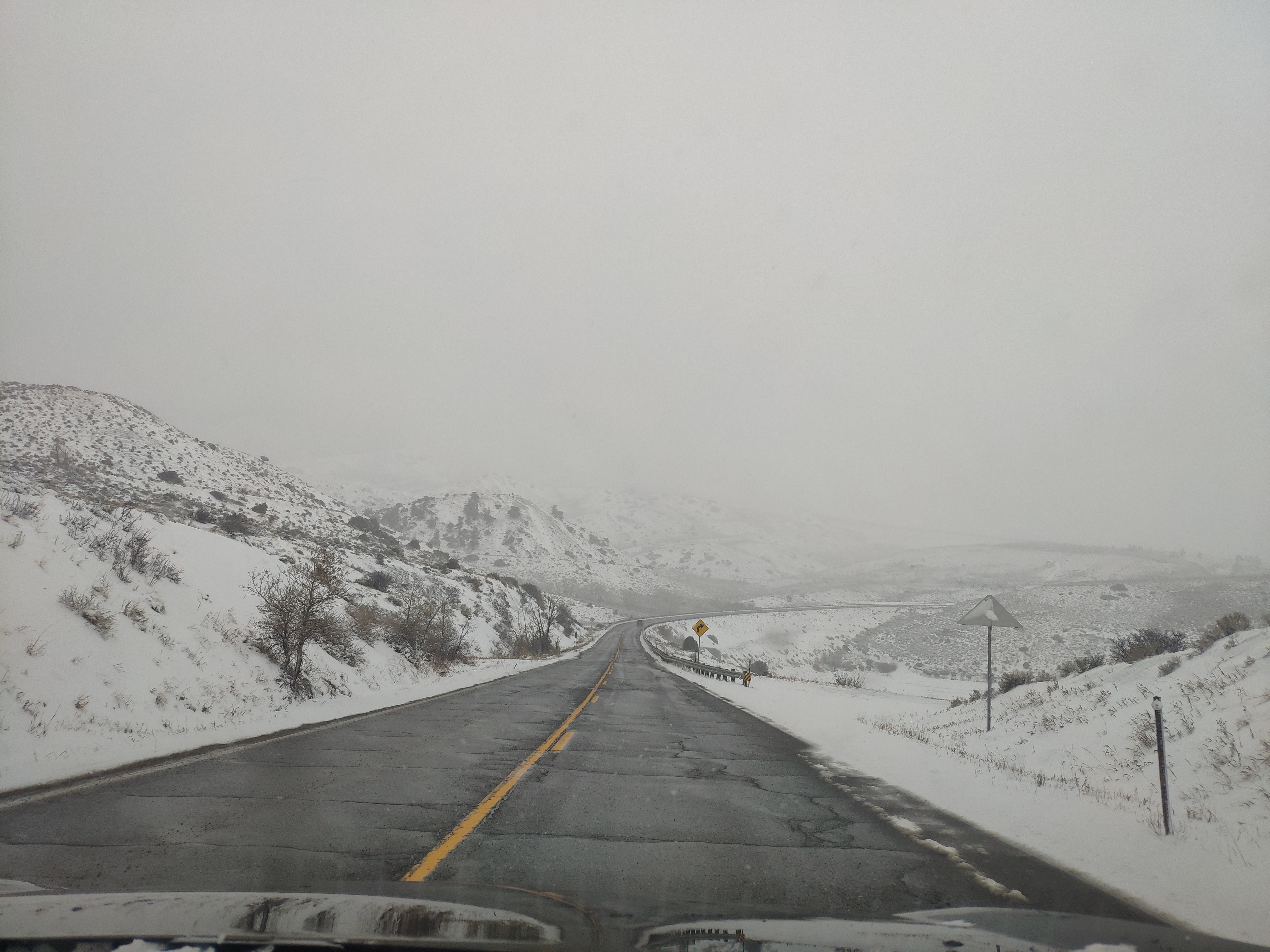
Captured on: 2021-03-14 17:18:21
GPS location: 39.869947, -106.269676 Altitude: 2,446m
Camera: Xiaomi MIX 2S Focal:4.22 ISO:100 Shutter:10.26
Description: Once-in-a-hundred-year storm in Denver (not much snow in mountains but airport alone had 27 inches per day). Usual 1.5 hour drive becomes an 8 hour torture due to our (with Shabby) bad luck and wrong decisions, one after another. When we arrived at our hotel in Denver (the whole city was buried), not a single restaurant was functional.
Captured on: 2021-01-18 14:17:31
GPS location: 37.622528, -112.165956 Altitude: 2,416m
Camera: OnePlus GM1917 Focal:4.76 ISO:125 Shutter:10.35
Description: Trees and tree like rocks decorated by snow. Photo credit: Mengjie
Captured on: 2021-01-17 17:24:53
GPS location: 36.879180, -111.510634 Altitude: 1,263m
Camera: OnePlus GM1917 Focal:4.76 ISO:200 Shutter:5.64
Description: The famous landmark. Photo credit: Mengjie
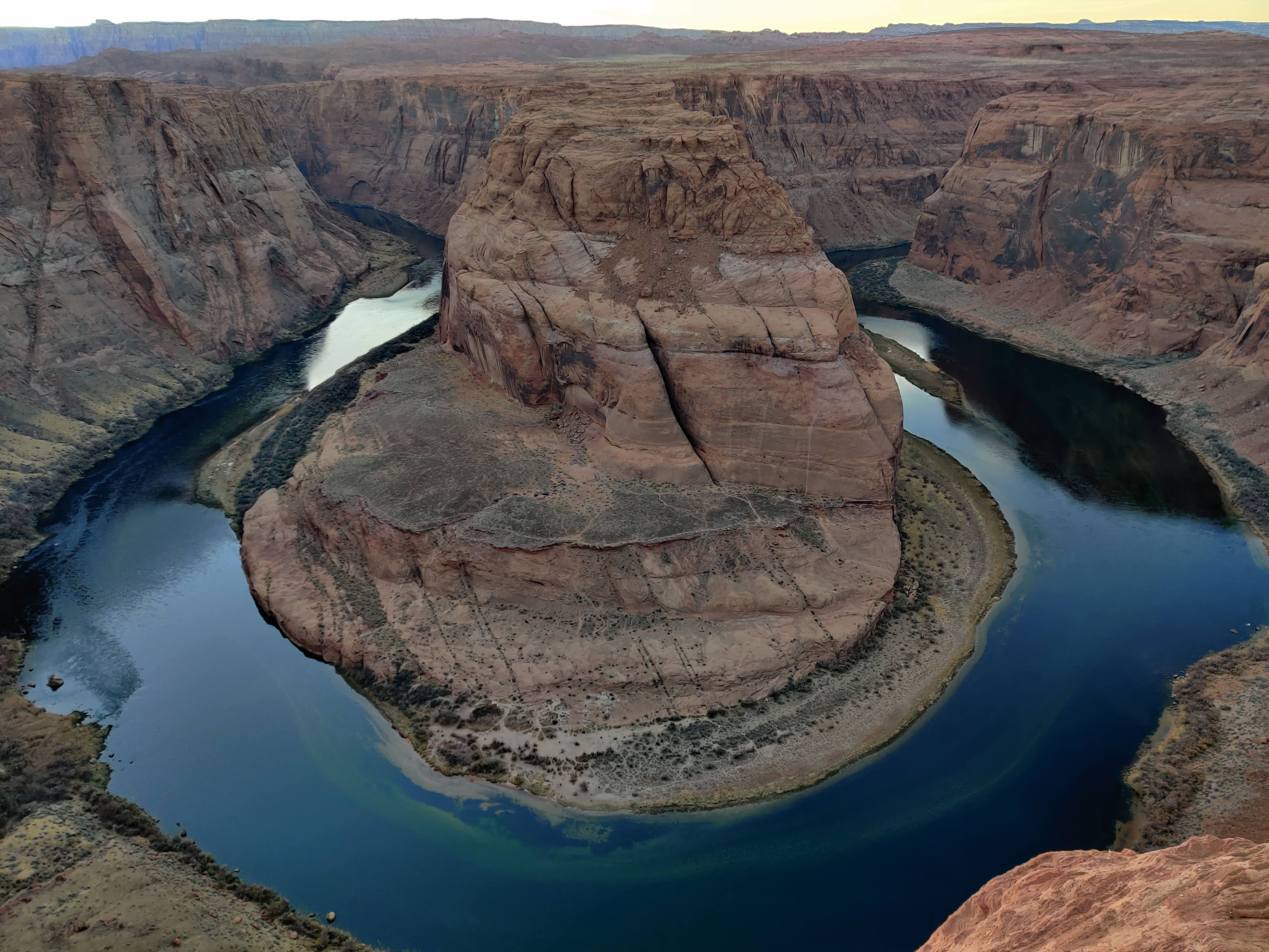
Captured on: 2021-01-17 16:02:00
GPS location: 36.879348, -111.510603 Altitude: 1,285m
Camera: NIKON CORPORATION NIKON D5100 Focal:30.00 ISO:100
Description: Colorado River bends between canyons. Photo credit: Ang

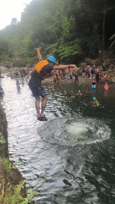
Captured on: 2021-01-17 13:57:30
GPS location: 36.954373, -111.443067 Altitude: 1,060m
Camera: OnePlus GM1917 Focal:4.76 ISO:125 Shutter:11.61
Description: Fell into to the 4 degree Centigrade water. Thanks Shabby for saving my life. Photo credit: Mengjie
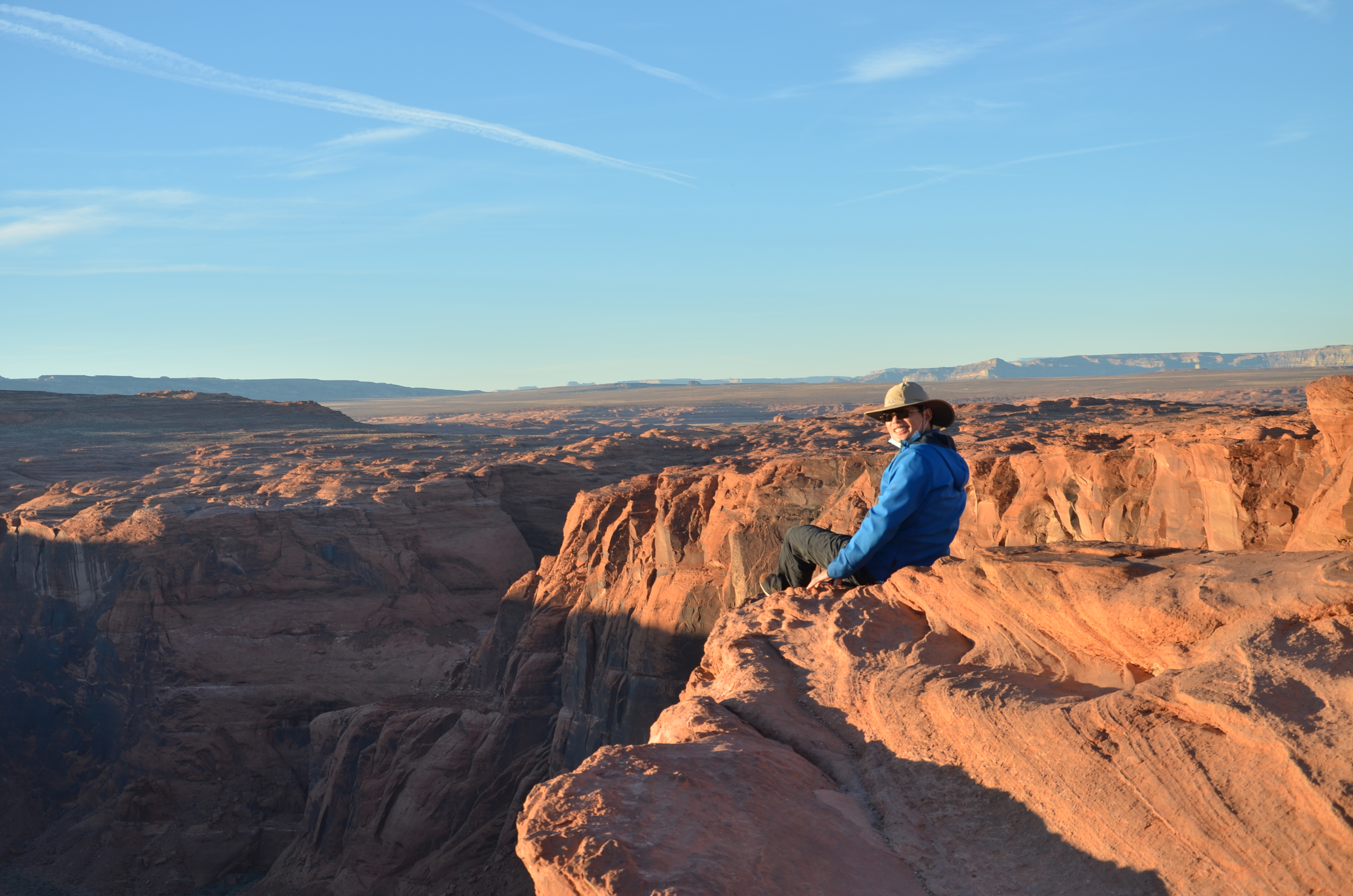
Captured on: 2021-01-16 17:15:49
GPS location: 37.269813, -112.950787 Altitude: 1,324m
Camera: OnePlus GM1917 Focal:2.25 ISO:200 Shutter:5.06
Description: Numerous turns to Angel's landing. Photo credit: Mengjie
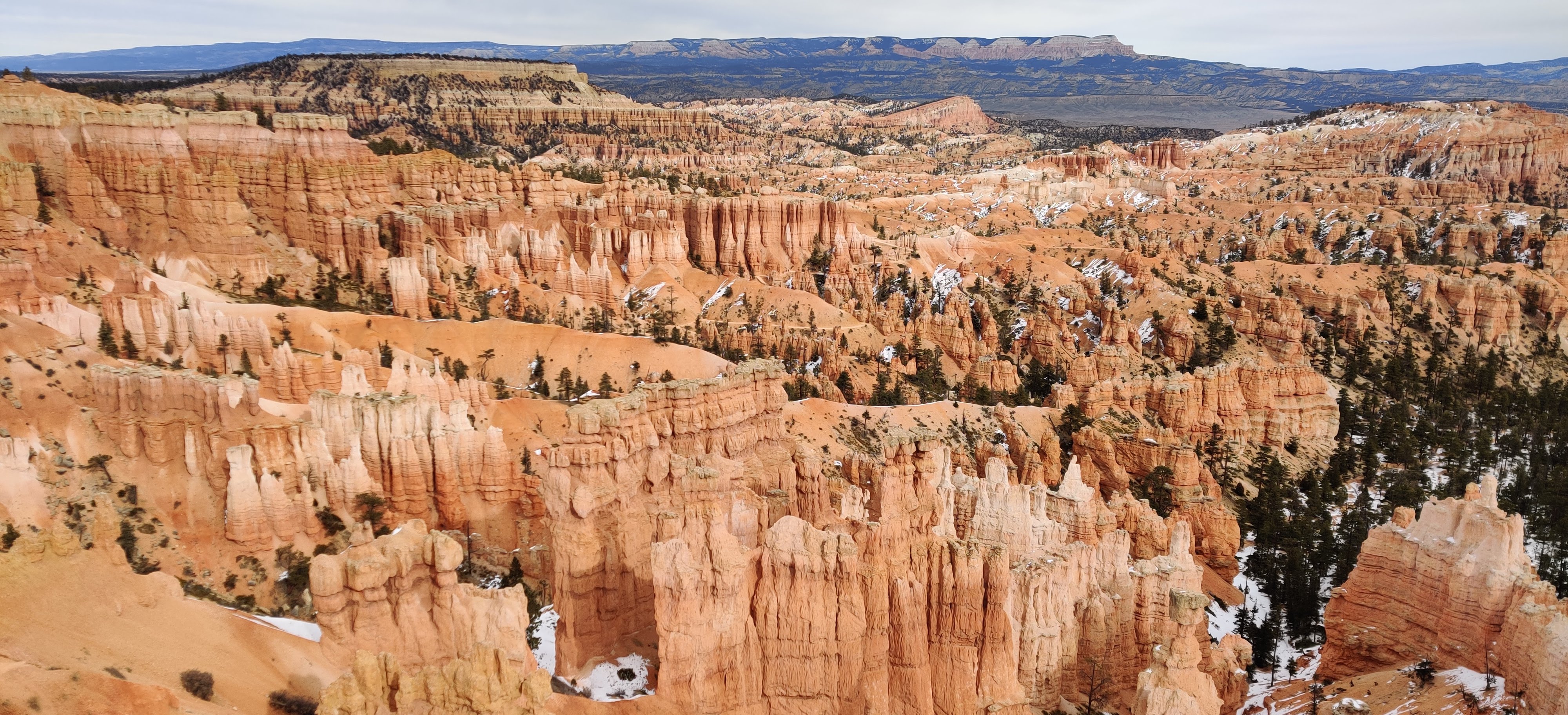
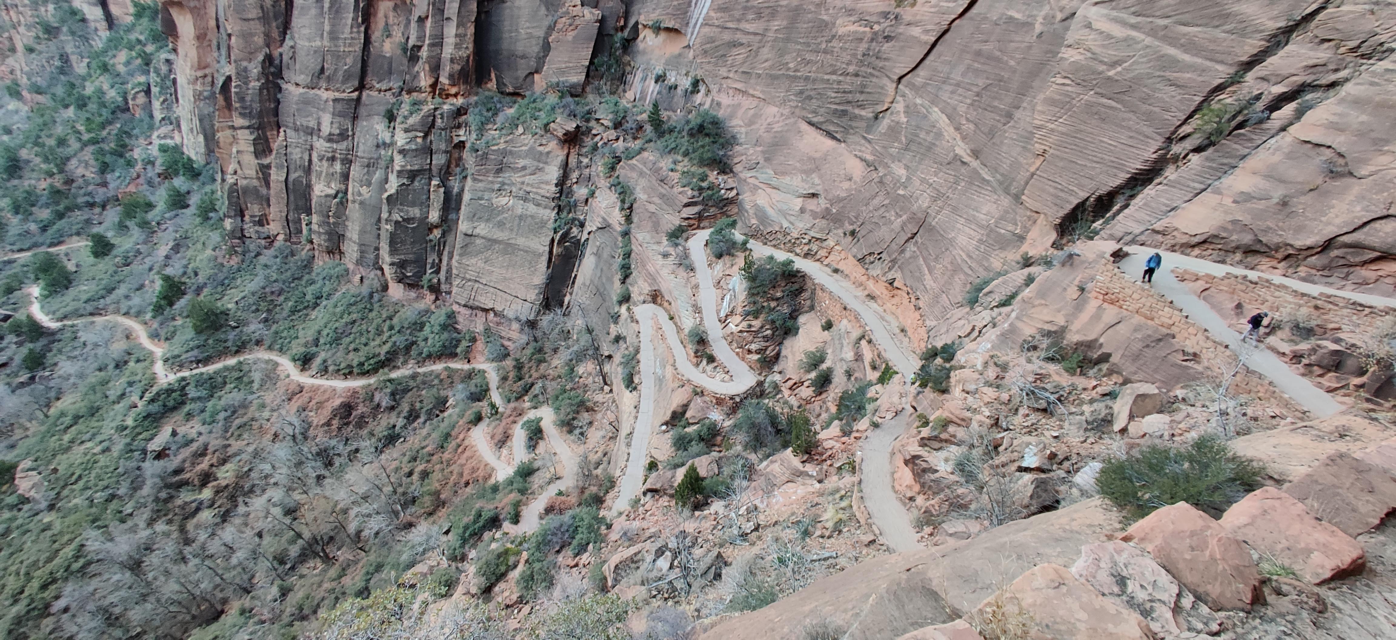
Captured on: 2021-01-16 17:05:10
GPS location: 37.269612, -112.950067 Altitude: 1,441m
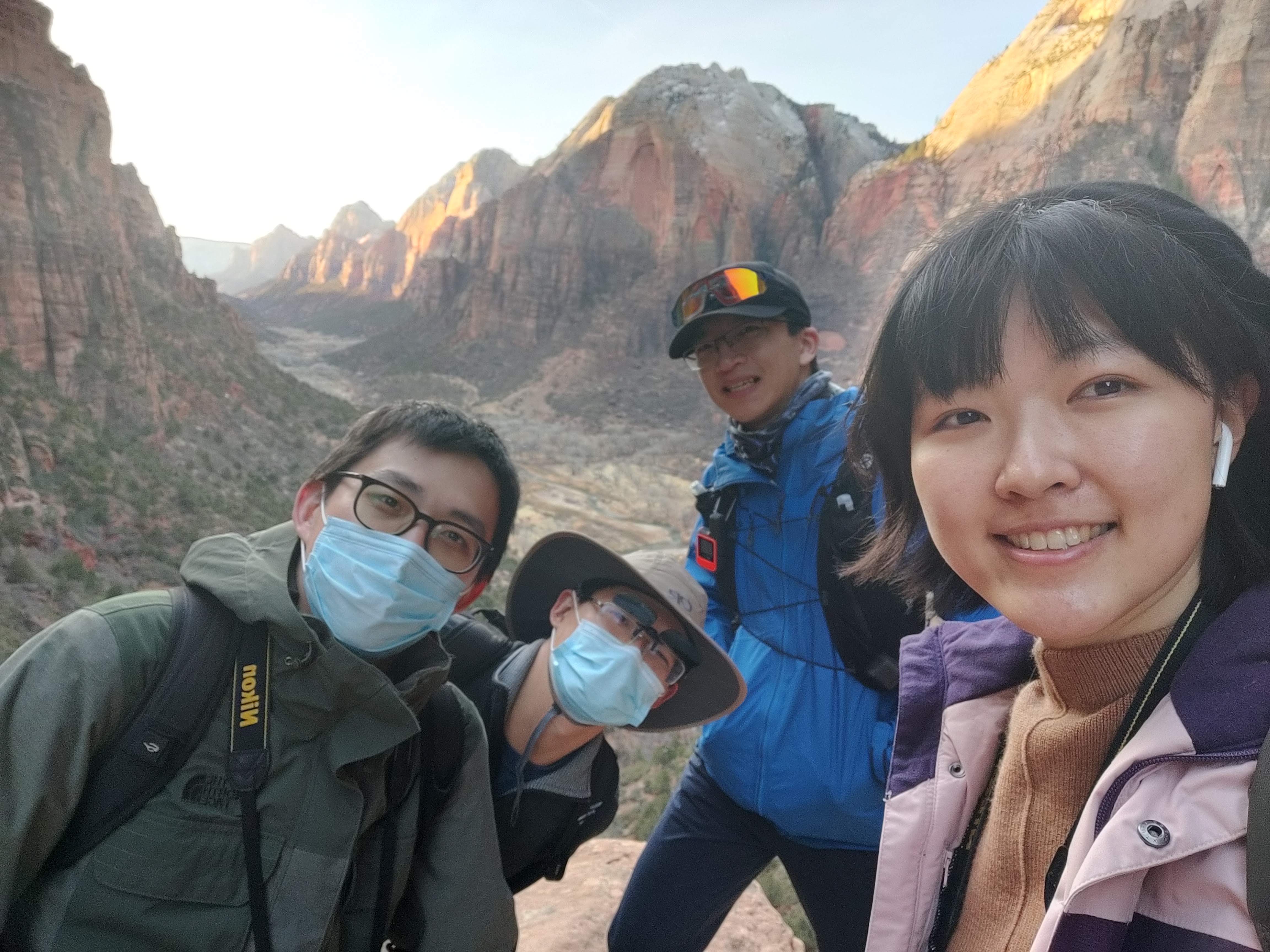
Camera: OnePlus GM1917 Focal:3.45 ISO:160 Shutter:5.64
Description: A farewell trip with three roommates to three national parks (Zion, Antelope, Bryce Canyon). Photo credit: Mengjie

Captured on: 2021-01-15 00:00:00
GPS location: 47.440815, -122.303218
Camera:
Description: No flight almost a year. This is the new way to travel during COVID.